While Grand Teton National Park offers many excellent hiking trails for all levels of abilities, we have decided this summer to spend more time away from the crowds on the trails of the US Forest Service. The trails, while still being well-maintained and most have vault toilets near the trail head (something that I prefer), are seldom used by the tourists. If you only have a limited amount of time in the park, most visitors will do the “popular” park trails. But if you have more time in an area, or want a more “serene” experience, then check out the forest service trails.
Our first hike, with our co-workers Shawn and Erin, was a trailhead behind Togwotee Mountain Lodge, at an elevation of 8654 feet. Brad, our boss and life-long resident in this area, recommended this trail to us, and said it’s “about 6 miles,” and “all downhill.” Since this was going to be a one-way, downhill hike, we left one vehicle down near Turpin Meadows, and took the other car up to Togwotee.
The wildflowers were in full bloom, which made the hike extra special. Even the vault toilet at the trailhead was surrounded by flowers.

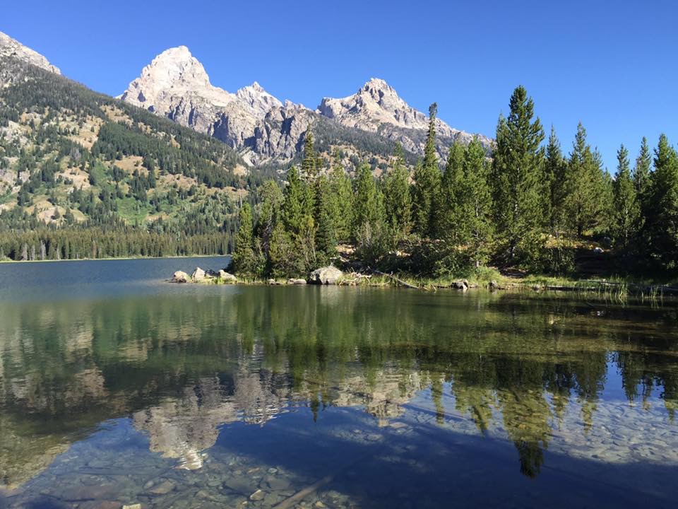
The Grand Tetons, about 45 miles away, are peeking out over the forest, with wildflowers covering the hills.

Erin, Shawn and Dan, on our “downhill” hike…

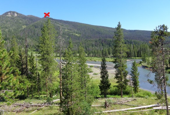
We made it down to the river. You can see where we started, by the red X in the photo. Dan checked his elevation app that he has on his phone, and it said we were down to 6800 feet, from the 8600 feet when we started.
But once we made it down to the river, we realized the trail did not follow along the river, but instead went straight up a hill. Brad and Joanne don’t go hiking, they take their horses and go riding in the forest. That should have been our clue when he said it was all downhill…..!
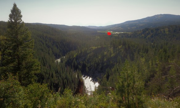
So off we went up a steep hill, only to realize once we were at the top, there was another one we had to climb as well! It was a bit of a struggle, as I checked my Fitbit, and we had already hiked over 6 miles. Once we made it to the top of the second hill, Dan’s app read 7800 feet. But we could finally see the end in sight. In the photo below, our car is where the red mark is. Only a few more miles…
All together, the “6 mile, all downhill” hike that Brad recommended, was 8 1/4 miles, with 1800 feet downhill, followed by 1000 feet uphill and another 1000 feet downhill. When we mentioned to Brad about the uphill portion, he said “oh yeah, but it’s only 20 minutes,” to which we replied “if you’re on a horse!” But the spectacular views, and seeing the wildflowers in full bloom, was well worth it. And we were the only ones on this hike. We had the forest to ourselves!
BROOKS LAKE/JADE LAKE HIKE
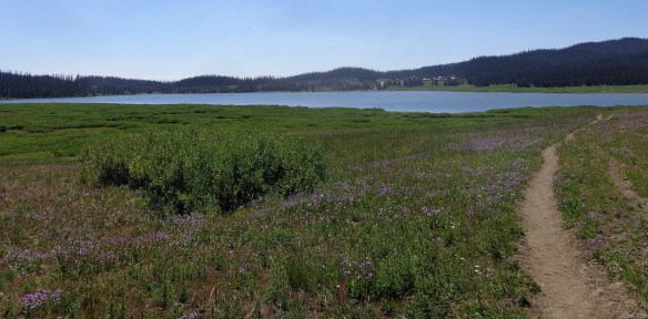
Dan and I spent another one of our off days taking advantage of another forest service hike, at Brooks Lake, which is part of the Continental Divide Trail.

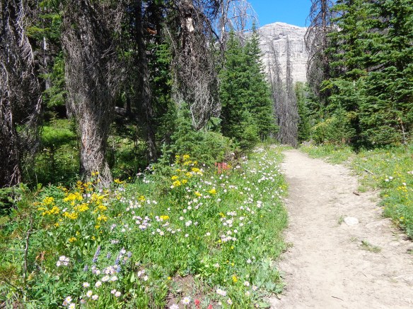
The loop trail starts at an elevation of 9100 feet, and is relatively flat for the first 1/2 mile. Then you climb 700 feet in one mile, which may not sound like much, but when you are starting out at such a high elevation to begin with, it really gets your heart rate elevated. We had to go up and over the tree line in the photo below.

We took it slow, and stopped several times. Dan asked if I wanted to turn around, but this time we knew that once we made it to the top, the remaining five miles would be relatively easy. After 40 minutes, we finally made it to the top. Then it was just a another mile until we got our first view of Upper Jade Lake, which was spectacular.

The trail gradually descended down to the lake. The wildflowers were just past their peak, but still pretty.
We had to cross over the river between upper and lower Jade Lake, and the trail wound around lower Jade Lake.

The trail crossed over the river two more times, before going out into a meadow for the last mile of the trail. I managed to make three of the four river crossings without a problem. On the last crossing, one of the rocks that I stepped on moved, and down I went into the river! The water was cold, but it was so hot out, it was actually refreshing. And on a positive note, I discovered the hiking “fanny pack” that I use, is waterproof, as everything inside the bag was dry.
Since the last mile was out in the open, I was able to dry out a little on the way back to the truck. We had a nice view of Brooks Lake on the way back. Our truck was parked on the other side of the lake. I usually bring a change of shoes/socks when we hike, but from now on, it will include a complete change of clothes!
WORK UPDATE
We continue to be busy at Luton’s Teton Cabins, at least for another week. Then we enter the “change-over” of the summer, when kids are back to school, so the family vacations end, and the “newlyweds and nearly deads” begin their vacations. We will have about one week when our occupancy is light. It will be a much appreciated break, as our cabins are full for the month of September. The downtime will give us time to clean and prepare the truck and fifth wheel for our trip to Arizona for the winter.
Quote for the Day: “Of all the paths you take in life, make sure a few of them are dirt.” – John Muir

Thaank you for writing this