Kennecott Mines National Historic Landmark

Located within Wrangell-St. Elias National Park (the largest national park in the United States) is Kennecott Mines National Historic Landmark. It was the top item on my personal list of things to see and do in Alaska, and it did not disappoint. Part of the allure of visiting this landmark is the challenge of getting to it.

McCarthy Road

And so it begins…

In order to reach the towns of McCarthy and Kennecott, you must first begin a 60 mile drive on an unpaved road that was originally used by the railroad servicing the mine. It is recommended to have a spare tire with you, as they are still uncovering railroad spikes in the gravel. You also need to be prepared for road washouts – they were repairing one section on the day we traveled. But it’s a beautiful and historic drive.

The road begins in the town of Chitina (pronounced “Chit-Na”) which was a major stop for the trains from Kennecott to the ships in the port city of Cordova. The log cabin below, constructed in 1910, is one of Chitina’s oldest buildings, and now serves as a National Park Service visitor center.

Historic log cabin

View of the Copper River along McCarthy Road.

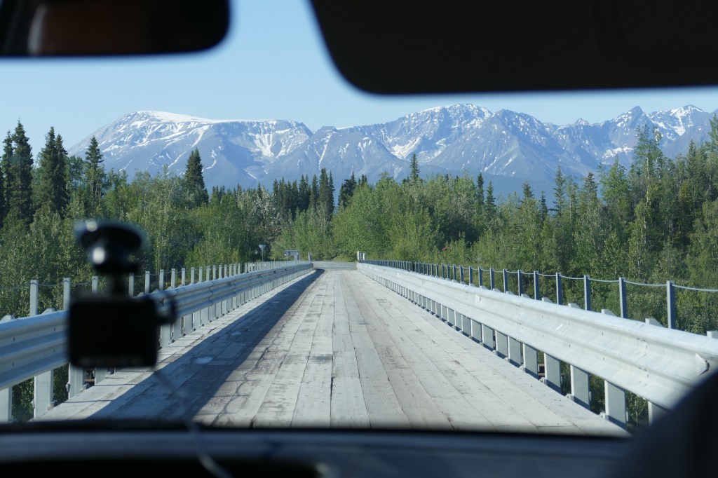
The Kuskulana River Bridge was built in 1910. This single-lane railroad bridge is 238 feet above the Kuskulana River.

My “back seat” view as we were driving across the one lane wooden bridge.

Twenty-nine miles into our trip on McCarthy Road we encounter the Gilahina Trestle, which was constructed in eight days during the winter of 1911. Over 15% of the railroad was built on wooden trestles like this, because of the rugged landscape. It’s really hard to believe it supported a train. It looks more like a Disney tower of terror train ride!

Once you reach the end of the 60 mile McCarthy Road, the journey is still not complete. Next up, you walk over a footbridge and wait for a shuttle bus to take you into the town of McCarthy. Or you can walk a half-mile from the footbridge into the town of McCarthy.

McCarthy is 4 1/2 miles downhill from Kennecott and was a supply and recreation spot for the mining town. The mining employees worked seven days a week, so they didn’t have much time to visit this little isolated town. Since we still had not made it to Kennecott, and had to wait for another shuttle bus to take us on the last 4 1/2 miles of our journey (with an elevation change of 3,000 feet) we did not have time to check out the little shops. It looked like a fun little town.

Town of McCarthy

Three and a half hours after we began our journey, we arrived in Kennecott!

History of Kennecott Mines

As gold prospectors started exploring the area, a young mining engineer, Stephen Birch, joined expeditions in 1898 and 1899. In 1900, prospectors Clarence Warner and Jack Smith discovered the Bonanza Ridge and staked copper claims in this area. Given the remoteness of the area, a lot of money was needed to mine in this area. Stephen Birch sought out financial backing from the Havermeyer, Guggenheim and J.P. Morgan families and formed the Kennecott Copper Corporation. The town of Kennecott was established and grew along with the mining and mill operations.

A total of four underground mines were developed and operated twenty four hours a day, seven days a week until the operation closed in 1938 due to declining concentrations of ore, along with declining prices for the ore. It was no longer profitable to continue mining here. Over 4.6 million tons of ore was extracted from the mines producing almost $300 million dollars worth of copper and silver (and a profit of over $100 million for the Corporation). The mines are not available for touring, and the entrances to them have been filled with concrete to keep people out.

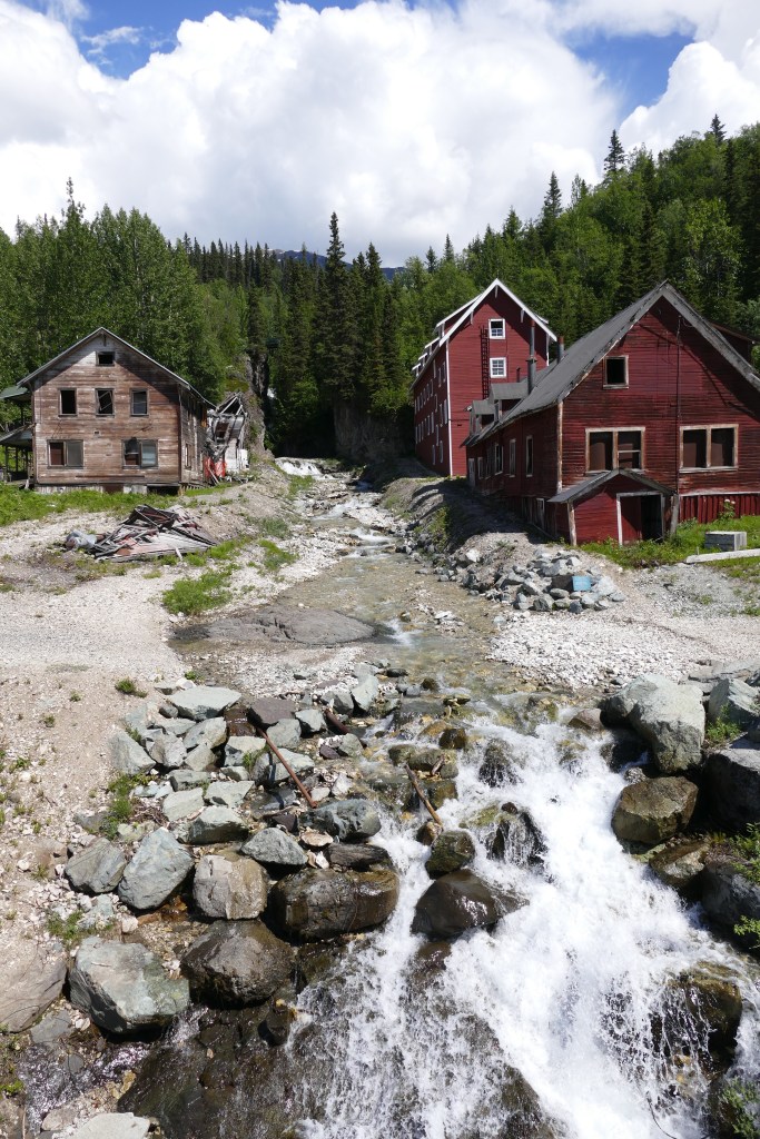
The town is perched right above the Kennicott Glacier and the Root Glacier. (Yes, the glacier and the town have two different spellings – one with an ‘i’ and the town with an ‘e’). It makes for a beautiful setting. In the photo below, the Root Glacier remains snow covered in the background. The Kennicott Glacier’s ice is covered by rocks and dirt, called a moraine.

Kennicott Glacier left, Root Glacier back right

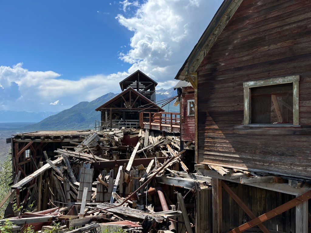
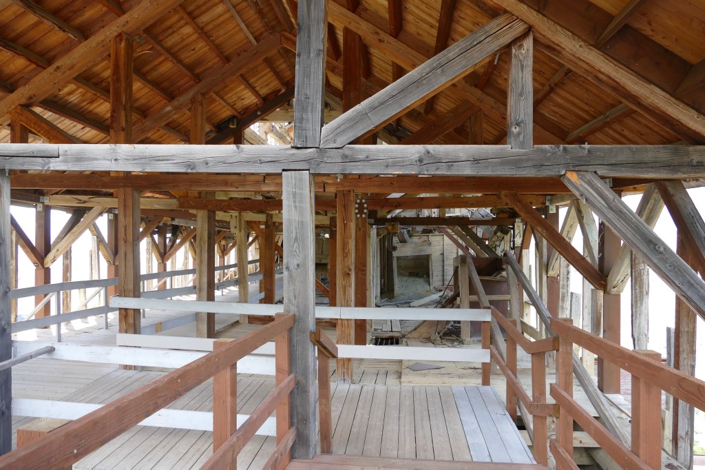
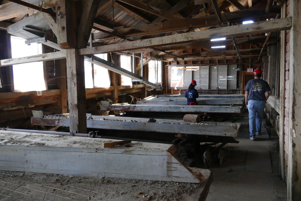
The 14 story Concentration Mill is the highlight of the Kennecott Mines Historic Landmark. The mill underwent many changes over a twenty year period as new techniques were developed in processing the ore. This is why the building looks like a hodge-podge of buildings put together. The train cars would pull right into the building in the center for loading of the processed ore.

A view from the other side of the mill has a better view of the different structures that were added on.

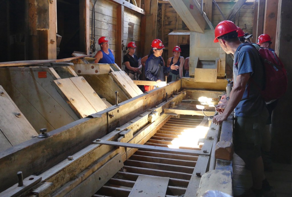
The only way to see the inside of the building is on a guided tour (cost $28.00 – totally worth it!). Unless of course you have an issue with heights, as you start the tour on top, and descend down all 14 stories of the building on steep steps and ladders that have been added by the park service, since some areas are no longer safe.

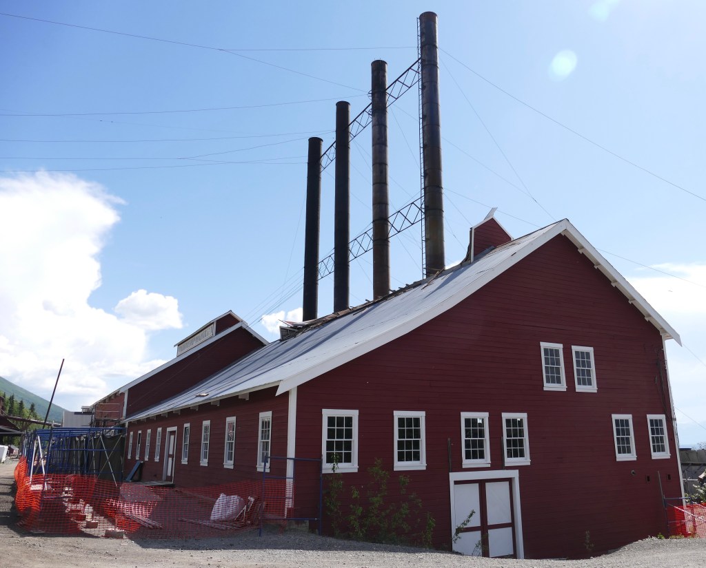
A short walk up a path alongside the mill takes you to the stop, and the start of the tour. There are amazing views of the area. This is the view to the right, of the Kennicott Glacier (what looks like piles of dirt) and part of the town including the power plant (4 smokestacks).

Another view of the Kennicott Glacier and the top buildings of the mill.

Views to the left show some of the restored building in the town, along with the Kennicott Glacier (again this is not piles of dirt from the mine, it is the moraine, covering up ice).

Entry way into the mine

The building just beyond the entry way has collapsed.

But the park service has built a walkway to connect to the next building.

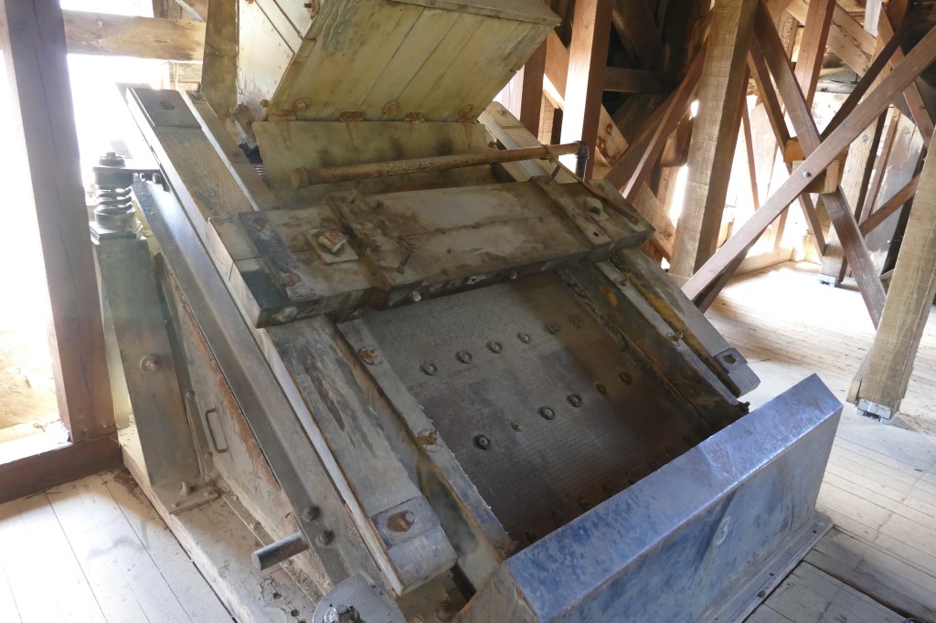
The ore and rock were delivered to the mill from the mines via a tramway. The mill was able to process 1200 tons of ore per day. It was cheaper to process the ore here, before shipping it down to Tacoma, Washington for final processing. The ore went through a series of crushers and sorters before being placed in burlap bags and put on the train.

Crushing machine

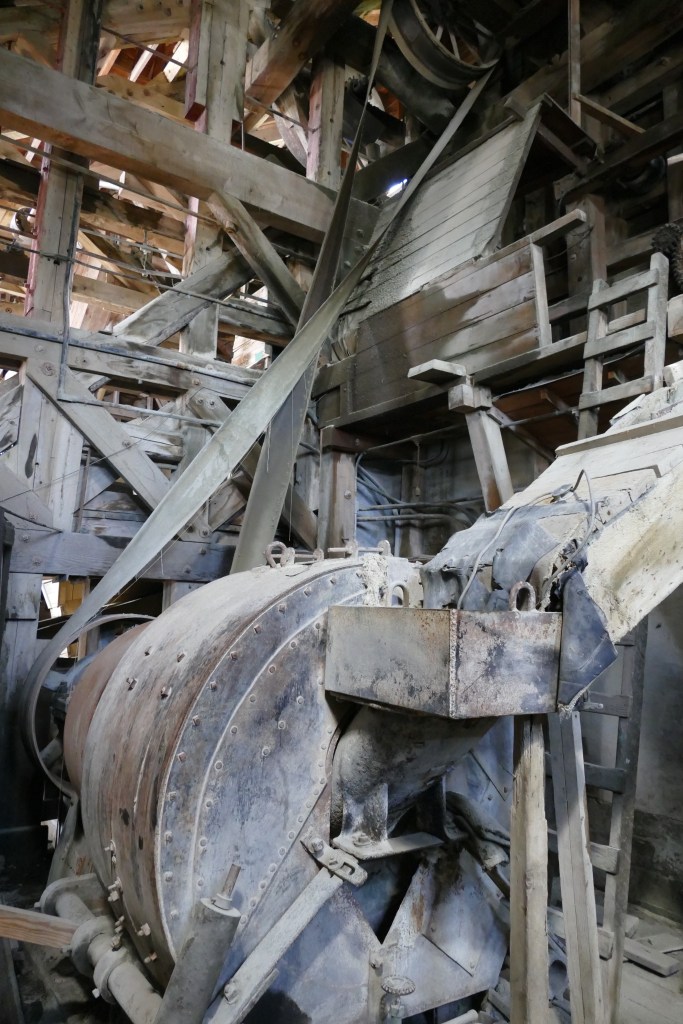
Several different styles of sorting machines were used.

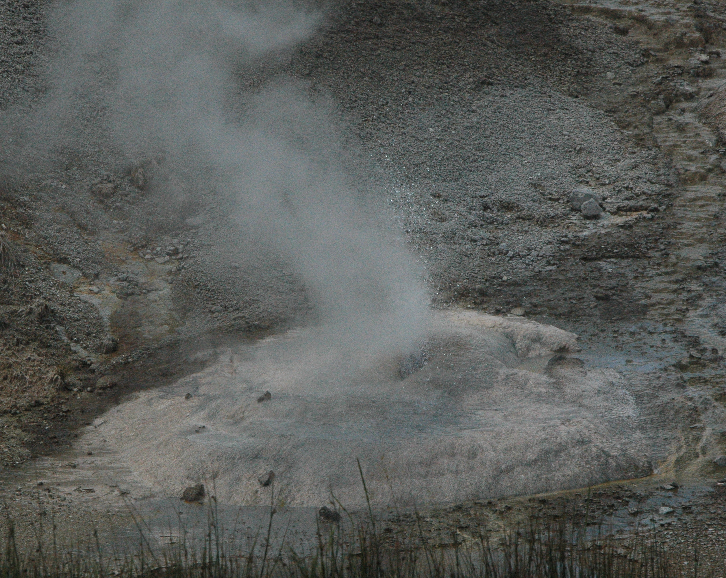
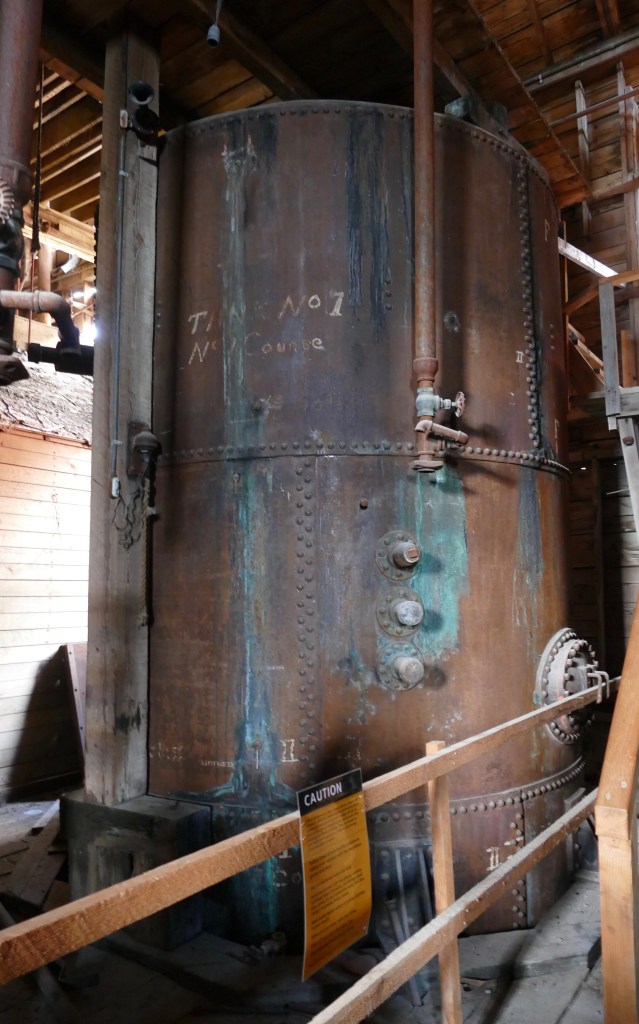
In order to maximize the profitability of the mine, low grade ore was put into tanks of ammonia which dissolved the copper in the ore. That solution was placed in another tank which was heated so the remaining ammonia evaporated off. The ammonia tanks have been preserved.

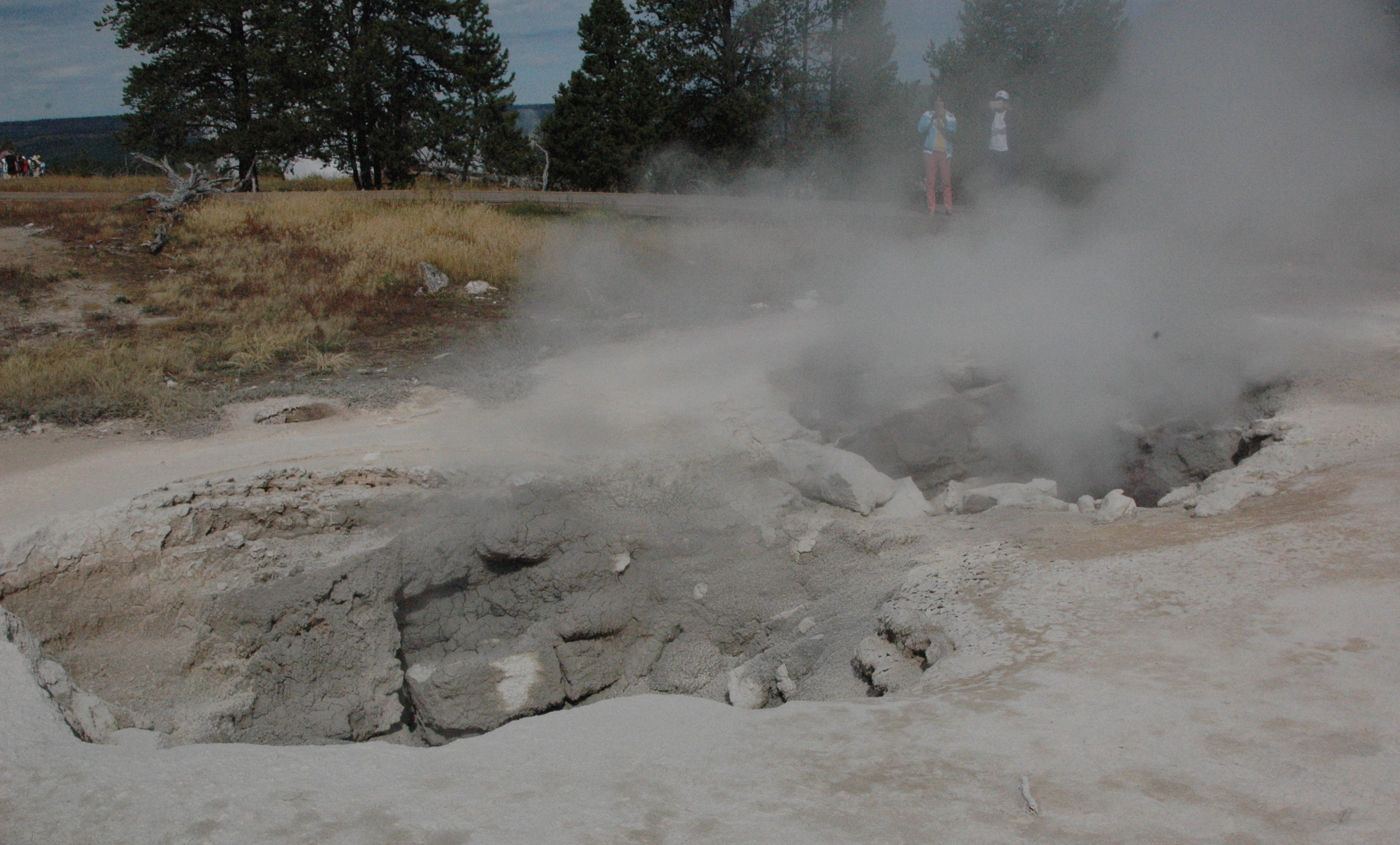
The power plant was not open for tour, as the roof collapsed over the winter from a heavy snowfall. The park service is working on restoring the building.

Power Plant

Several bunkhouses were built to house the men working for the mine. They had to pay $1.25 for room and board, which included meals. A school was also built, which not only provided education for the children, but adults as well. In 1920, the school educated 126 adult students from 23 countries that were working at the mill. The corporation taught English and helped the employees study for their citizenship.

Bunkhouse and School buildings

While the employees had shared quarters, the managers were able to live in small cottages with their family. They paid about 25% of their wages to live in them. Several of the remaining cottages are privately owned residences (purchased before the park service took over operation of the town in 1998). They have one that has been restored and open to the public.

Interior of the cottage

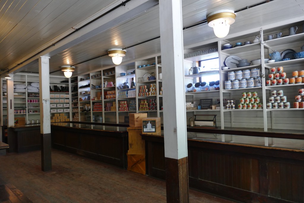
The town had it’s own Post Office and General Store for the employees.

In 1915, a hospital was built which was not only used by the mill employees, but members of surrounding communities. The first X-ray machine in Alaska was used at this hospital. Once a month a dentist would arrive for check-ups. Employees had eight cents per day deducted from their checks for medical/dental coverage.

The hospital is on the left and two bunkhouses for employees are on the right. The buildings were damaged from a flood several years ago.

An additional view of the town, with the train station on the lower right, and a glimpse of the Root Glacier in the background on the left.

Town of Kennecott

And finally, this is what started it all…

It was a long day touring this historic landmark, but definitely worth the challenge of getting there.

Quote of the Day: “The meek shall inherit the Earth, but not it’s mineral rights.” – J. Paul Getty

Bryce Canyon National Park

After our short trip to Page with Tom and Ellen, we headed up into Utah, to re-visit one of our favorite National Parks, Bryce Canyon.  The park contains the largest concentration of hoodoos, which are irregular columns of rock.  The hoodoos are formed through erosion of the cliffs from the wind, rain and snow.   As some of the rock formations erode away, new ones are created.  The park is always changing.  As we arrived in the park on May 1, just in time for what seems to be our annual May snowfall!

img_2536

Left Yuma too soon??

Given the snow, and our limited time in the park (2 days), we were not able to do any hiking in the park.  We stayed at Ruby’s Inn campground, in their brand new pull-thru section.  It’s pricey, but very nice.  The family that owns Ruby’s Campground, owns the majority of the businesses in the area.  And they hire a lot of work campers for the season.


We were able to meet up with our friend Bob, that we worked with at Amazon a few years ago.  Bob decided to get his commercial drivers license, with a passenger endorsement.  This has opened up a lot of high-paying work camping opportunities for him.  In order to ease up on overcrowding, and the pollution that goes along with it, the National Park service is using shuttle buses in many of the parks.  Bryce Canyon has a free shuttle service taking visitors to most of the viewpoints in the park.  Bob was able to get a job as a shuttle bus driver.  For those interested, it pays $24/hour, with a discounted RV site.

img_3045

Bob, Dan, Ellen, Tom and Jonell

When we told Bob that we were coming, he booked us on a free shuttle tour of the park, as he wanted to check out the tour as well.  If you plan on visiting Bryce, I would highly recommend the free tour.  This is separate from the regular shuttle that just takes you to the overlooks. It is called the Rainbow Point tour, and lasts three hours.

This is the view from Rainbow Point, elevation 9115 feet.  The park borders Dixie National Forest, and off into the distance is Grand Staircase – Escalante National Monument.

P1050023 (2)

This is the view at Agua Canyon, elevation 8800 feet.  Can you see the “face” in the rock formation on the left?

P1050048 (2)

The Natural Bridge is at elevation 8627 feet.

P1050092 (2)

The view at Bryce Point, elevation 8296 feet, is one of the prettiest in the park, containing many hoodoos.  You can hike down into the canyon to get a better view of the rock formations.

P1050201 (2)

More views at Bryce Point…

P1050257 (2)

P1050253 (3)

P1050256 (2)

There are over 60 miles of hiking trails in the park, and someday we will return to hike down into the canyon for a closer look at these amazing hoodoo formations.

P1050276 (2)

One thing I want to point out for anyone traveling to Bryce Canyon in an RV, they have two arches that you have to drive through to get to the park.  For whatever reason, they have signs stating 13 feet, 6 inches.  This would give pause to anyone driving an RV, particularly a fifth wheel.  The height of our 5th wheel is 13-3.  I’m not sure who did the measuring, but as you can see from Tom and Ellen’s fifth wheel going through the arch, there is plenty of room.

P1050446 (2)

If you are interested in Astronomy, they have special programs at the park in June; and in July, they have programs for those interested in Geology.  We plan on coming back to the park someday to hike down into the canyon.

Quote for the Day:  “Stepping out onto any lookout, you are invited to connect with an amazing example of some of the most unusual terrain on this planet, making you feel as though you are stepping foot on the edge of another world.” – Stefanie Payne


A quick trip to Page, Arizona

We had a one-day stop in Page, Arizona, with our friends Tom and Ellen, and certainly made the best of a rainy day, with a quick trip between storms to see Horseshoe Bend Overlook and tour Lower Antelope Canyon.  The scenery was spectacular, even if the weather was not co-operating.

HORSESHOE BEND OVERLOOK

Horseshoe Bend Overlook is where the Colorado River makes a 270 degree bend around the rocks in Glen Canyon National Recreation Area.  I’ve seen many photographs of this area, but never really knew where it was.  The orange rock is Navajo Sandstone.

After you park and walk up a small hill, you are greeted with this view.  If you look closely, you can see dozens of people in the middle right of the picture.

P1040481 (2)

All those people were looking at this:

P1040500 (2)

Horseshoe Bend Overlook

If you look really close at the above picture, down at the bottom of the middle, you may notice a couple of yellow kayaks.  Here is a zoomed in photo:

P1040496 (2)

Yes, there were people tent camping right on the bend.  And, there is even an outhouse down there (not sure who gets to clean that!).  I think this would be an amazing spot to kayak and tent camp overnight at.  Not sure if this requires a special permit or not.

Even though they charge $11.00 for parking, it is definitely worth a stop to see this overlook…even in the rain!

LOWER ANTELOPE CANYON TOUR

We were scheduled for a late afternoon tour of Lower Antelope Canyon, but it was cancelled due to the rain.  Flash flooding is a serious concern, and several people were killed a few years ago when the canyon flooded before they could get out.  This is why the only way to enter the canyon now, is with a guided tour.  Fortunately, we were able to reschedule the next morning.

Lower Antelope Canyon is a slot canyon, made out of Navajo Sandstone.  The tour takes about one hour, and you will walk approximately one mile.  There are stairs leading down into the canyon, and back out of the canyon.  In between, you have many slots to pass through.  It’s not recommended for people who are claustrophobic, but the beauty of the canyon may keep your mind off the fact that you are in a small space.  My photos really do not do justice to the colors of the sandstone.

P1040523 (2)

Going down into the canyon

There are many narrow passages…


P1040525 (2)

Lots of different formations made over time by the wind and water coming through the canyon…

img_2481-1

The light shining down from above, creates different shades of color throughout the day…

img_2512-1

img_2459

Canyon Arch

Before they added stairs, visitors would climb up the rocks using the gouges in the rocks shown below.

img_2427

We had a great time during our all too brief visit to Page.  There are many things to do in the area, and we are considering stopping back in the fall on our way back to Arizona.  But work beckons, so we had to keep going on our journey.  Stay tuned…

20190430_091318-1

Dan, Jonell, Ellen and Tom

Quote for the Day:  “All the lessons are in nature.  You look at the way rocks are formed – the wind and the water hitting them, shaping them, making them what they are.  Things take time, you know?” – Diane Lane


Exploring the national forests

While Grand Teton National Park offers many excellent hiking trails for all levels of abilities, we have decided this summer to spend more time away from the crowds on the trails of the US Forest Service.  The trails, while still being well-maintained and most have vault toilets near the trail head (something that I prefer), are seldom used by the tourists.  If you only have a limited amount of time in the park, most visitors will do the “popular” park trails.  But if you have more time in an area, or want a more “serene” experience, then check out the forest service trails.

Our first hike, with our co-workers Shawn and Erin, was a trailhead behind Togwotee Mountain Lodge, at an elevation of 8654 feet.  Brad, our boss and life-long resident in this area, recommended this trail to us, and said it’s “about 6 miles,” and “all downhill.”  Since this was going to be a one-way, downhill  hike, we left one vehicle down near Turpin Meadows, and took the other car up to Togwotee.

The wildflowers were in full bloom, which made the hike extra special.  Even the vault toilet at the trailhead was surrounded by flowers.

DSC05253 (2)

The Grand Tetons, about 45 miles away, are peeking out over the forest, with wildflowers covering the hills.

DSC05273 (2)

Erin, Shawn and Dan, on our “downhill” hike…

DSC05272 (2)

We made it down to the river.  You can see where we started, by the red X in the photo.  Dan checked his elevation app that he has on his phone, and it said we were down to 6800 feet, from the 8600 feet when we started.

DSC05296 (2)_LI

But once we made it down to the river, we realized the trail did not follow along the river, but instead went straight up a hill.  Brad and Joanne don’t go hiking, they take their horses and go riding in the forest.  That should have been our clue when he said it was all downhill…..!

So off we went up a steep hill, only to realize once we were at the top, there was another one we had to climb as well!  It was a bit of a struggle, as I checked my Fitbit, and we had already hiked over 6 miles.  Once we made it to the top of the second hill, Dan’s app read 7800 feet.  But we could finally see the end in sight.  In the photo below, our car is where the red mark is.  Only a few more miles…

DSC05304 (2)_LI

All together, the “6 mile, all downhill” hike that Brad recommended, was 8 1/4 miles, with 1800 feet downhill, followed by 1000 feet uphill and another 1000 feet downhill.  When we mentioned to Brad about the uphill portion, he said “oh yeah, but it’s only 20 minutes,” to which we replied “if you’re on a horse!”  But the spectacular views, and seeing the wildflowers in full bloom, was well worth it.  And we were the only ones on this hike.  We had the forest to ourselves!

BROOKS LAKE/JADE LAKE HIKE

Dan and I spent another one of our off days taking advantage of another forest service hike, at Brooks Lake, which is part of the Continental Divide Trail.

DSC05344 (2)

The loop trail starts at an elevation of 9100 feet, and is relatively flat for the first 1/2 mile.  Then you climb 700 feet in one mile, which may not sound like much, but when you are starting out at such a high elevation to begin with, it really gets your heart rate elevated. We had to go up and over the tree line in the photo below.

DSC05310 (2)

We took it slow, and stopped several times.  Dan asked if I wanted to turn around, but this time we knew that once we made it to the top, the remaining five miles would be relatively easy.  After 40 minutes, we finally made it to the top.  Then it was just a another mile until we got our first view of Upper Jade Lake, which was spectacular.

DSC05319 (2)

The trail gradually descended down to the lake.  The wildflowers were just past their peak, but still pretty.

DSC05316

We had to cross over the river between upper and lower Jade Lake, and the trail wound around lower Jade Lake.

DSC05337

The trail crossed over the river two more times, before going out into a meadow for the last mile of the trail.  I managed to make three of the four river crossings without a problem.  On the last crossing, one of the rocks that I stepped on moved, and down I went into the river!  The water was cold, but it was so hot out, it was actually refreshing.  And on a positive note, I discovered the hiking “fanny pack” that I use, is waterproof, as everything inside the bag was dry.

Since the last mile was out in the open, I was able to dry out a little on the way back to the truck.  We had a nice view of Brooks Lake on the way back.  Our truck was parked on the other side of the lake.  I usually bring a change of shoes/socks when we hike, but from now on, it will include a complete change of clothes!

DSC05342 (2)

WORK UPDATE

We continue to be busy at Luton’s Teton Cabins, at least for another week.  Then we enter the “change-over” of the summer, when kids are back to school, so the family vacations end, and the “newlyweds and nearly deads” begin their vacations.  We will have about one week when our occupancy is light.  It will be a much appreciated break, as our cabins are full for the month of September.  The downtime will give us time to clean and prepare the truck and fifth wheel for our trip to Arizona for the winter.

Quote for the Day:  “Of all the paths you take in life, make sure a few of them are dirt.” – John Muir

The Little Rock Nine

Prior to our arrival in Little Rock, Arkansas, I had made a reservation with the National Park Service to visit Little Rock Central High School, which is both a historical landmark and an operating high school.  During the school year, tours are only offered twice a day, and only while the school is in session.  Reservations are required.  Across the street from the school, the Park Service has a visitor center with exhibits, and many audio recordings to listen to from the students, teachers, and residents of Little Rock that give first hand stories about the events that happened in 1957.  For us, this was one of the most impressive and informative National Park Service tours we have ever attended.

Little Rock Central High School was built-in 1928 at a cost of $1.2 million (yes, that’s million…in 1928!)  It is the most impressive high school we have ever seen.  At the time our of tour, there was a group of students from Chicago on a field trip, and they were amazed at the school.  Since it is an operating school, the tour is very limited to the main entrance, the auditorium and the cafeteria.  We would have loved to roam the halls of the building.  You could just feel the history.  Other than security cameras and elevators, it seems to have been left in its original state.  The staircases had wooden banisters, and the auditorium still had the original wooden seats.  It has a current enrollment of 2422 students for grades 9 – 12.  The school continues to thrive today, and is considered one of the 16 best schools to prepare students for college with over 177 different courses offered, 30 advanced placement classes, and five foreign languages taught.

The school is so big, I had to do a panoramic shot to get the entire front of the building in the photo.  There are over 100 classrooms in the building.  There were about 60 people in our tour group, and I think all of us said “wow” when we first saw the school, except for the one student from Chicago who remarked ‘our school is trash compared to this!’

DSC05130 (2)

Here is a close-up of the middle section of the school, where the main entrance is.

DSC05131

So why is this the only high school in America designated as a National Park?  Time for a brief history lesson.

“We the people” are the first three words of the Constitution as it was written in 1787.  But who does “we” represent?   White male landowners.  Over time, through amendments to the Constitution and the Bill of Rights,  the definition of “we” has expanded.   Some of these rights came as a result of protest, and the visitors center has details about how the rights of people have expanded as a result of individuals protesting.   Through protest, comes change.

DSC05110 (2)

DSC05111 (2)

In 1954, the US Supreme Court outlawed segregation in elementary and secondary schools in the Brown v Board of Education of Topeka, Kansas case.  The schools in the Southern states were slow to begin the process of integrating schools, which would allow students to go to the school in their own neighborhood, instead of getting bused across town.

The Little Rock school board quietly discussed how to integrate students at the high school level, and announced it would accept African-American students at Central High School.  But they only wanted a limited number of students, and would only accept those who had straight A’s and perfect attendance.  Over 200 students applied, and the school board realized that was too many.  So they continued to raise the bar on the standards.  No African American student would be allowed to participate in any athletic or club event.  No after school activities.  The students were only allowed to attend school, and must leave immediately at the end of the school day.  Eventually only 10 students were left.

This integration did not sit well with Arkansas Governor Faubus, and he ordered the National Guard to bar the African-American students from school.  On September 3, 1957, a mob gathered outside the school, along with the National Guard.  One of the parents of the 10 students, after seeing the angry mob, decided against sending their daughter to that school.  Nine students were left, but they did not attend the first day of school.

On the second day of school, the Arkansas National Guard barred the students from entering the school.  These 9 students were harassed, spit upon, and shoved around as they walked towards school.  Not by fellow students, but by the parents and community members that gathered daily around the school.  By September 20, a Federal judge rules against the use of the National Guard, and the Little Rock Police were responsible for the students safety.   On September 23, the Little Rock Nine (Terrence Roberts, Elizabeth Eckford, Ernest Green, Thelma Mothershed, Minnijean Brown, Jefferson  Thomas, Carlotta Walls, Gloria Ray and Melba Pattillo) finally entered the high school.  But the local police were overwhelmed by the angry mob and a riot broke out.  The police removed the students from the school.

By this time, media from around the country were broadcasting multiple times a day from the school.  A local gas station, which had a pay telephone, was set up for the reporters.  That gas station, across from the school, has been preserved as part of the history. (gas was 22 cents a gallon, by the way!)

DSC05135

People around the country were both horrified and supportive of what they were seeing coming out of Little Rock.  But President Eisenhower had seen enough, and federalized the Arkansas National Guard.  In addition, he sent in 1200 soldiers from the 101st Airborne Division to restore order and protect the students.  The soldiers escorted students into the school, and remained inside the hallways of the school to protect the nine students.  The soldiers were not allowed inside the classrooms or bathrooms of the school.  As a result, the nine students were physically and verbally abused in the classrooms and bathrooms by fellow students.

In 1957, there were around 2000 students attending the high school.  About 200 of the students were constantly harassing the nine students.  In listening to the audio recordings of the Little Rock Nine detailing their experiences, it wasn’t the action of the 200 students that bothered them, as much as the inaction of the 1800 students that just stood by and did nothing.  They called them the silent majority.

One of the nine students was expelled, after she was physically assaulted by a group of female students.  She did not physically retaliate, but called them “white trash.”  After her expulsion, students passed out cards stating ‘one down, eight to go.’  By November, the Airborne Division leaves, and the nine students continue to endure verbal and physical assaults for the remainder of the school year.

On May 25, 1958, Ernest Green became the first African-American student to graduate from Central High School.  In attendance at his graduation, was a man who wanted to watch this historical event, Dr. Martin Luther King.

But that’s not the end of this fight for integration.  Governor Faubus shut down all the schools in Little Rock for the 1958-59 school year, in order to block the integration of the school district.  A Federal Court ruled the closing of the schools was unconstitutional, and the schools reopened in August 1959.

All of the Little Rock Nine not only graduated from high school (not all from Central), but went on to college and had very successful careers.  Jefferson Thomas passed away in 2010 from cancer, but the other eight are still alive.

If you are ever in the Little Rock, Arkansas area, please try to do this tour.  Even if you only have time to look at the exhibits in the visitors center, it is worth the time.  What these students had to endure was truly heartbreaking, but their will to persevere is inspirational.


Quote for the day:  “Any time it takes 11,500 soldiers to assure nine Negro children their constitutional rights in a democratic society, I can’t be happy.”  – Daisy L. Gatson Bates


Cousins come a callin’

First off, thank you for all the wonderful comments, e-mails and telephone calls from our last blog post.  It really meant a lot.

Dan’s cousins, Roni and Jodi, made a long road trip from the Twin Cities to come out and visit with us for two days.  We tried to pack as much as we could in the short amount of time they had, and we think we succeeded.  The only thing they were not able to check off their list was seeing a grizzly bear.

We spent the first day on a quick tour of Grand Teton National Park, trying to stop at some of  the highlights: Colter Bay, Jackson Lake Lodge, Signal Mountain, String Lake, Jenny Lake, Lupine Meadows, The Chapel of Transfiguration, Schwabacher Landing, etc…

DSC04471 (2)

Dan, Jodi, Roni

DSC04472

After seeing some of  the highlights, we stopped in Moose for a little pizza at Dornan’s.  While sitting outside we were briefly entertained by a fox walking near the deck.

DSC04474 (2)
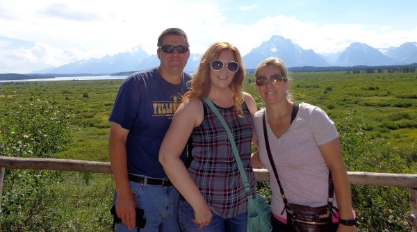
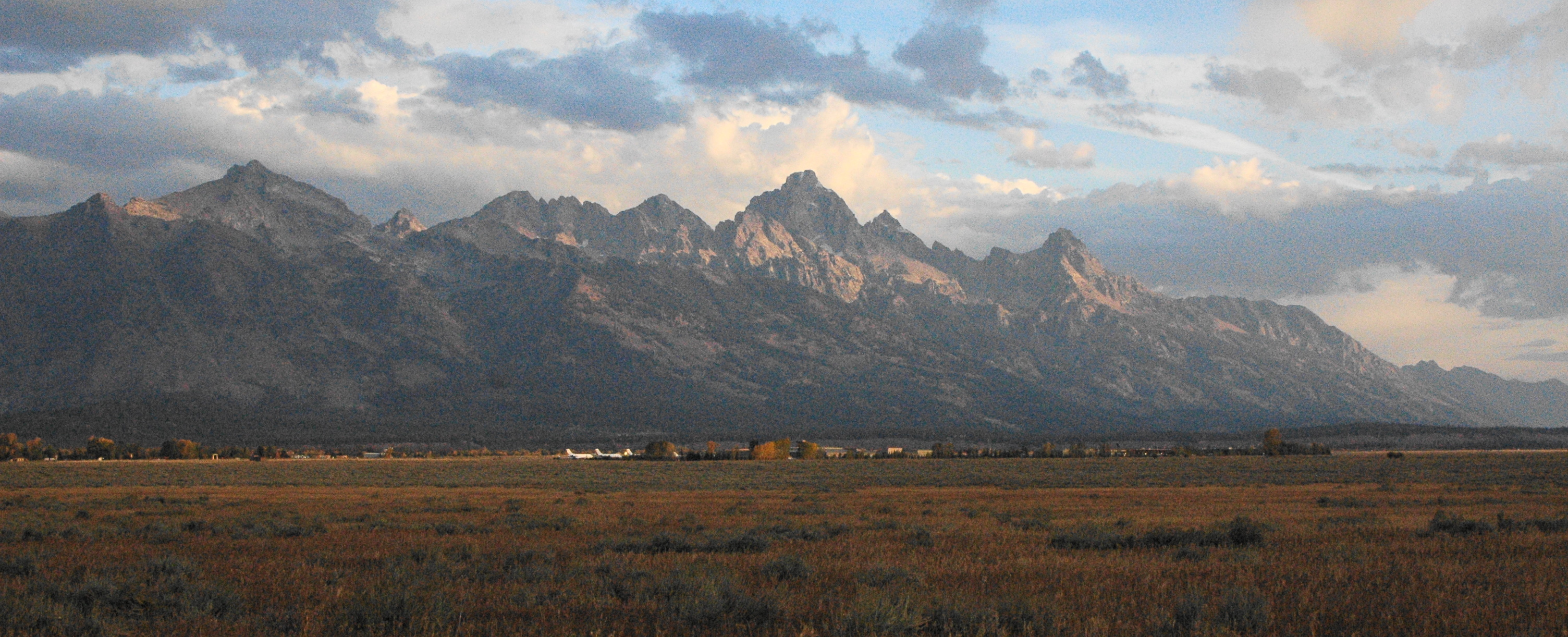
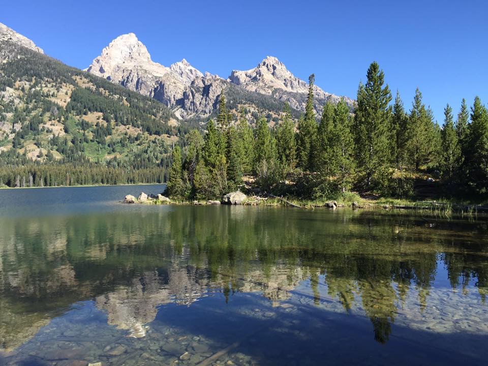
The next morning we headed up to Yellowstone, making a few stops in the Tetons to view a herd of Elk,

P1000307 (2)
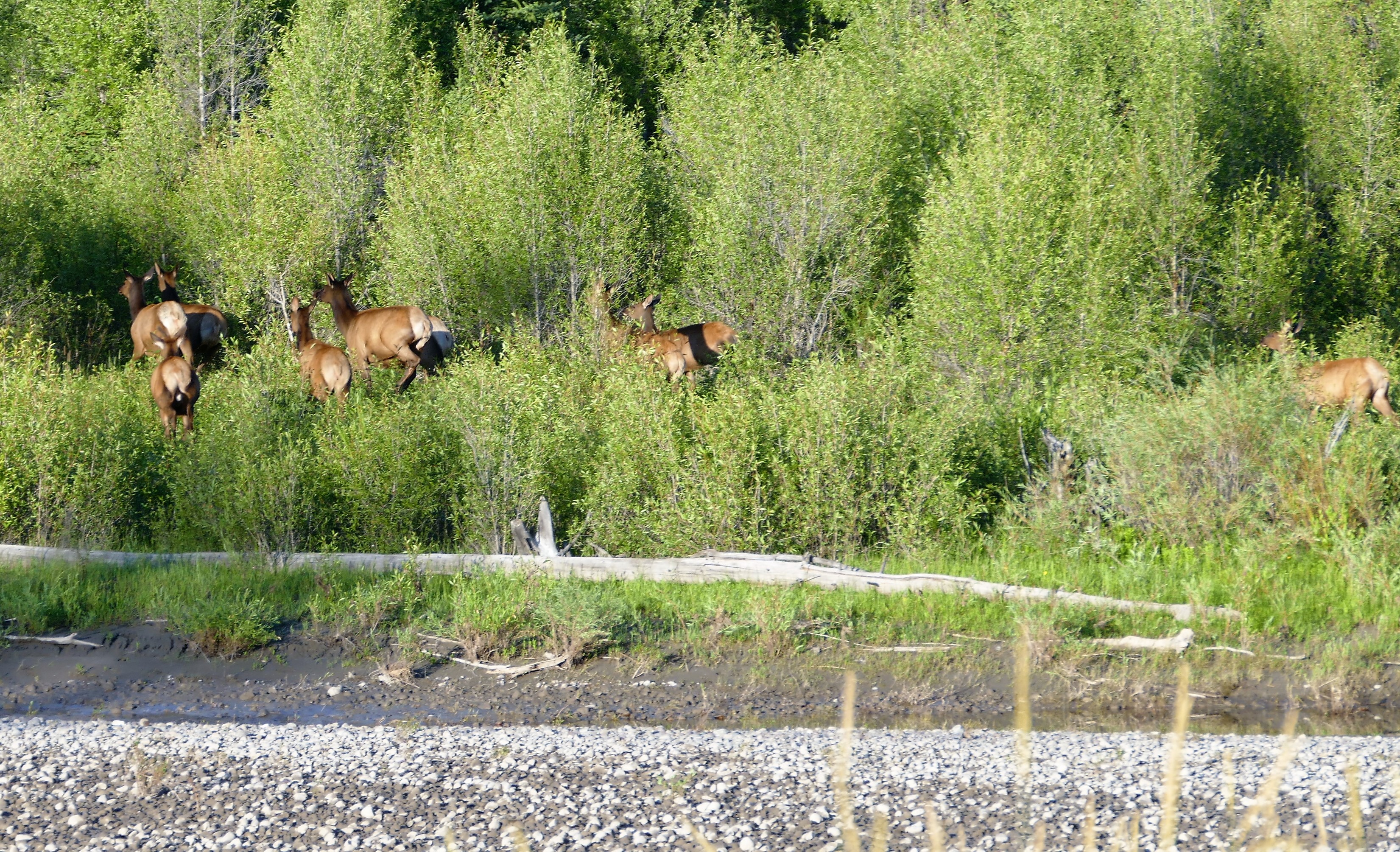
followed by a mama and baby moose!

P1000363 (2)
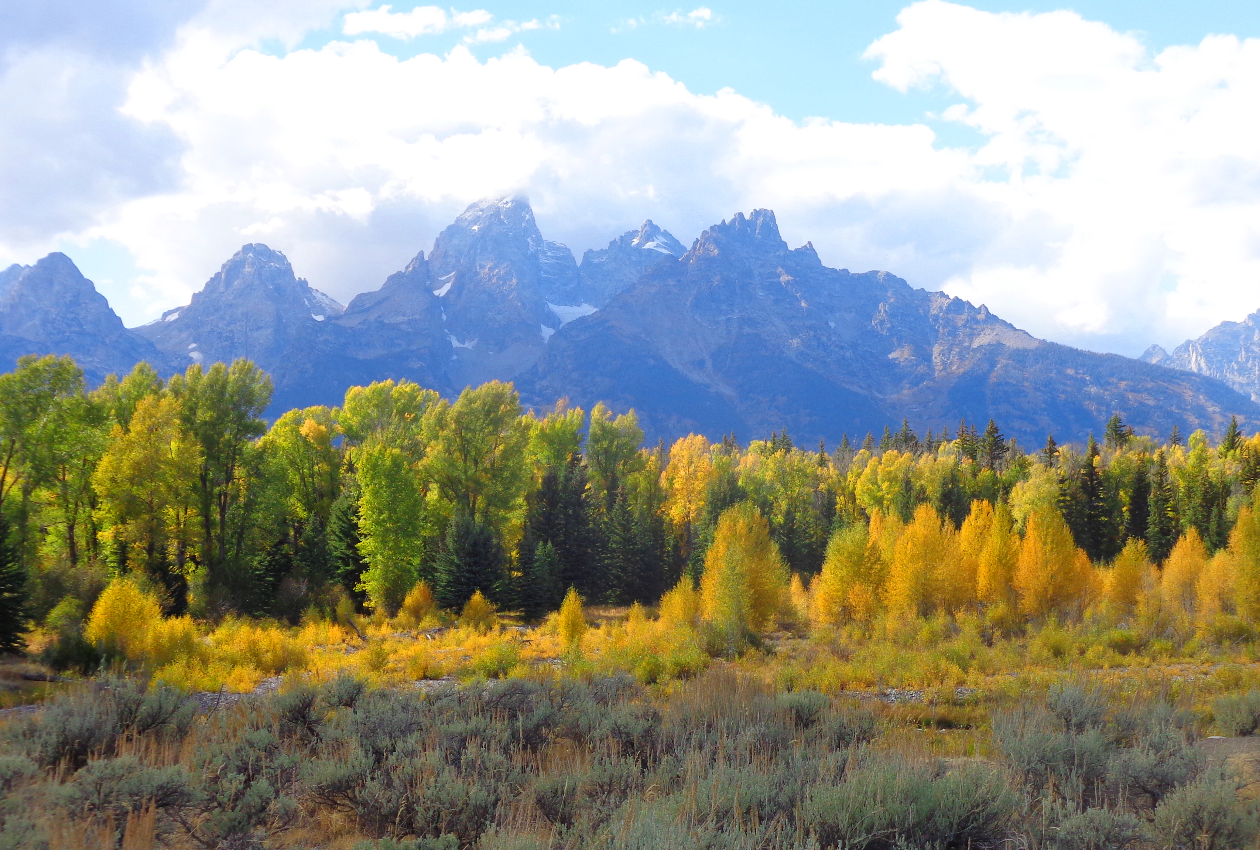
And no morning is complete without a stop at Oxbow Bend, with the low-lying clouds covering parts of Mt Moran.

P1000311 (2)

Yellowstone was pretty busy, but Roni said she had “positive vibes”, especially after our wonderful start to the day.  She was right, and we never had issues finding parking spots!  Our wildlife sightings continued, with an Osprey in a nest,

P1000516 (2)
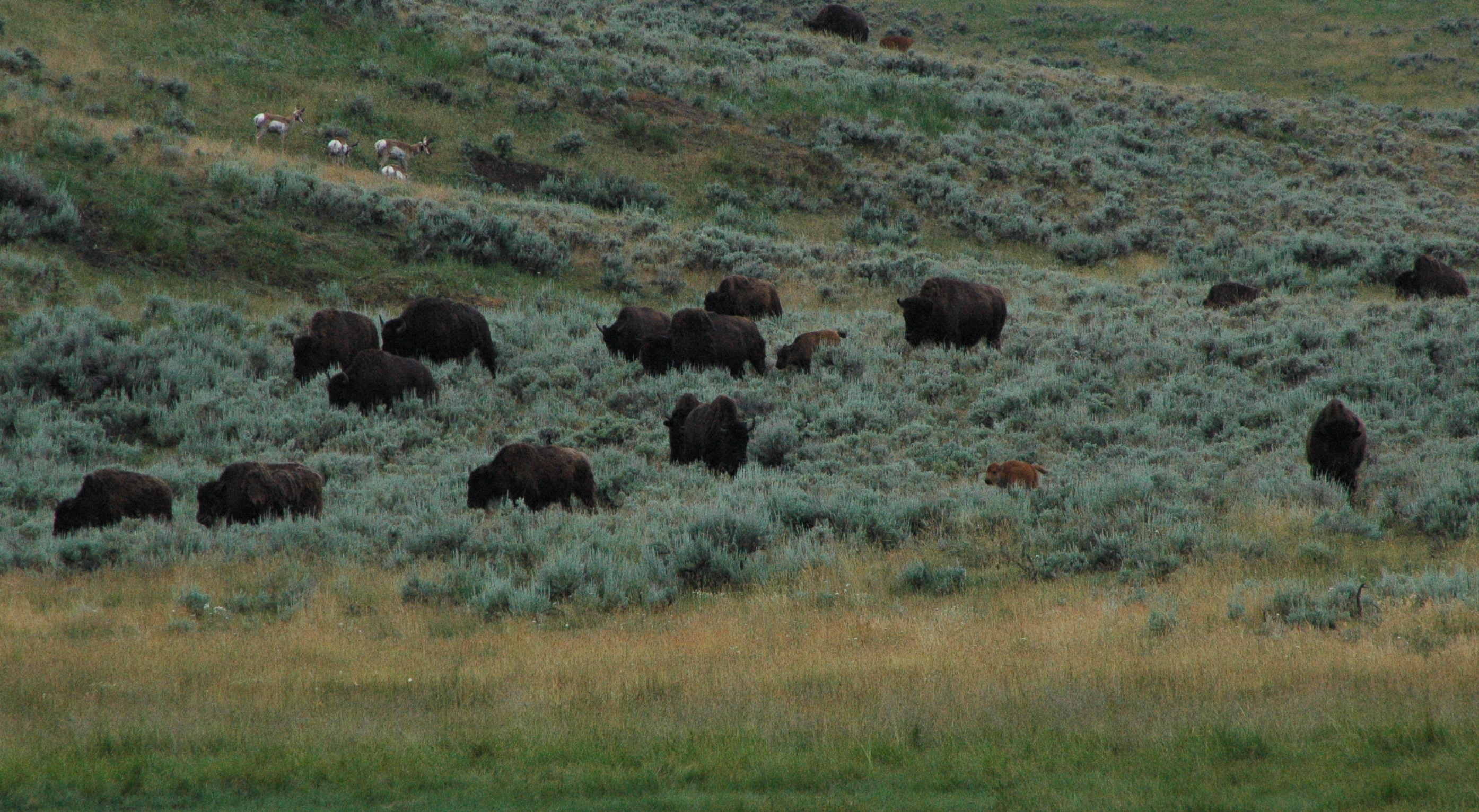
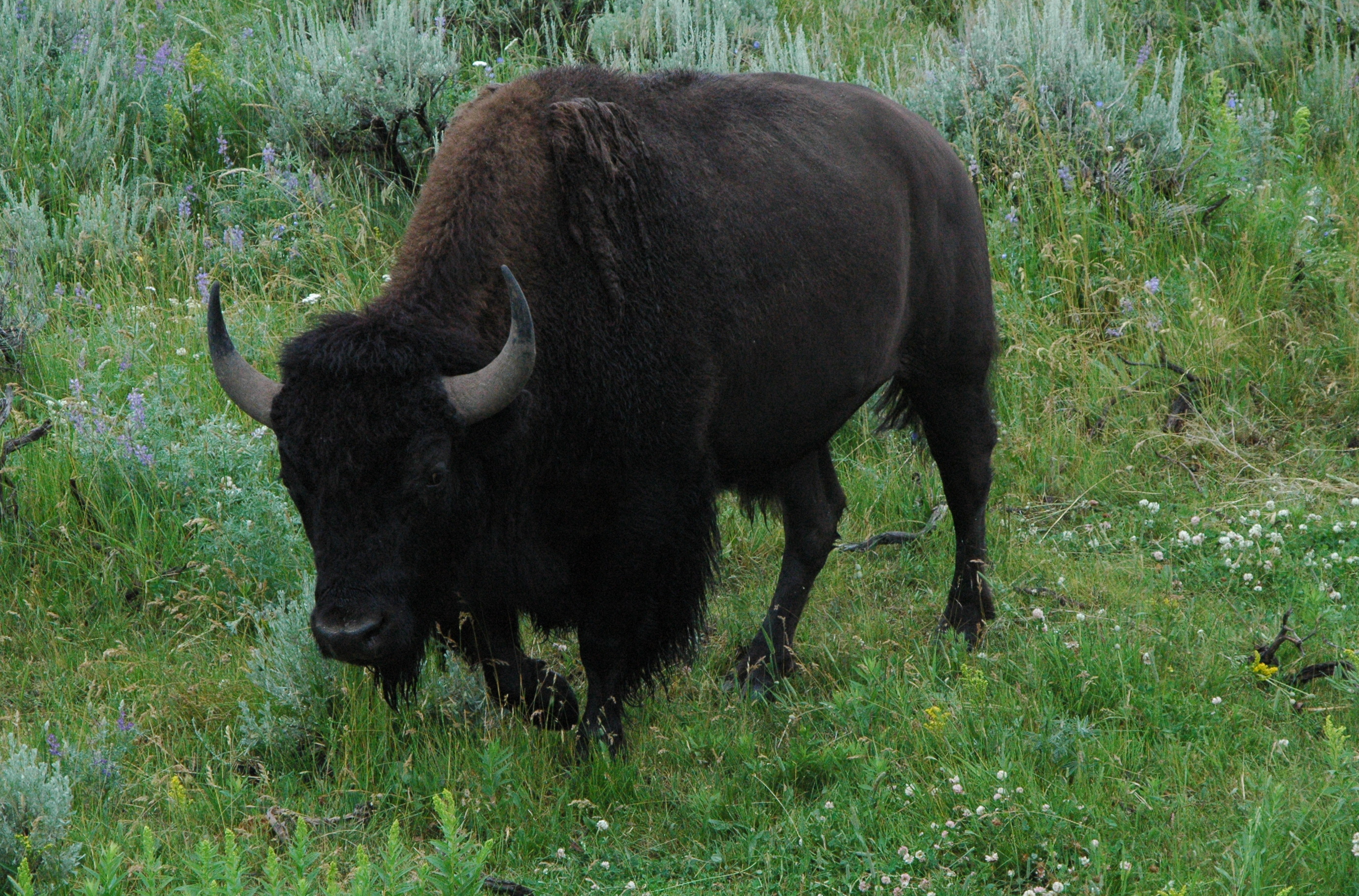
and a lone buffalo taking a nap along the side of the road!

P1000500 (2)The cousins were impressed with the view of the Lower Falls.

P1000429 (2)P1000426 (2)

I think Roni and Jodi may have a new future career in the park service!

P1000472 (2)
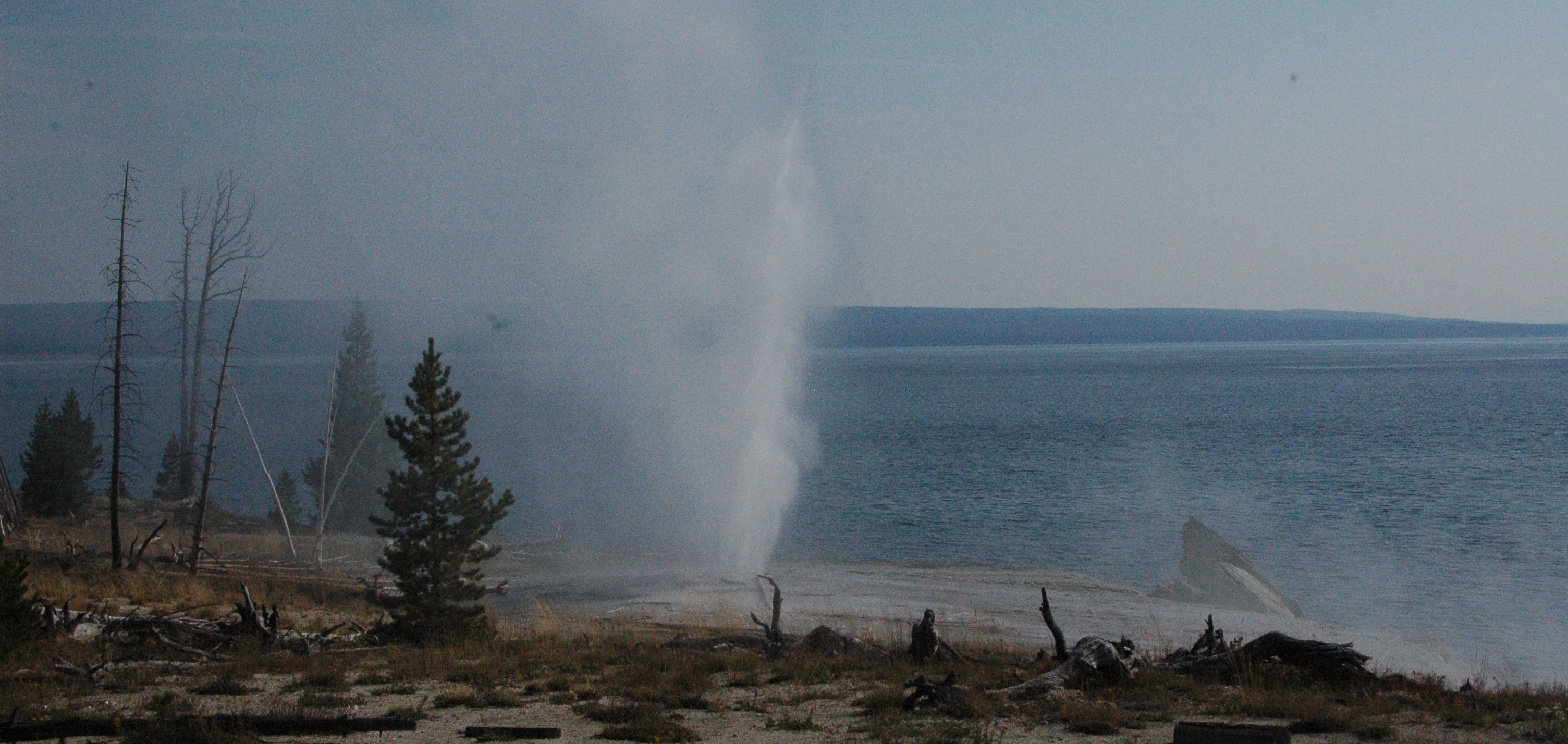
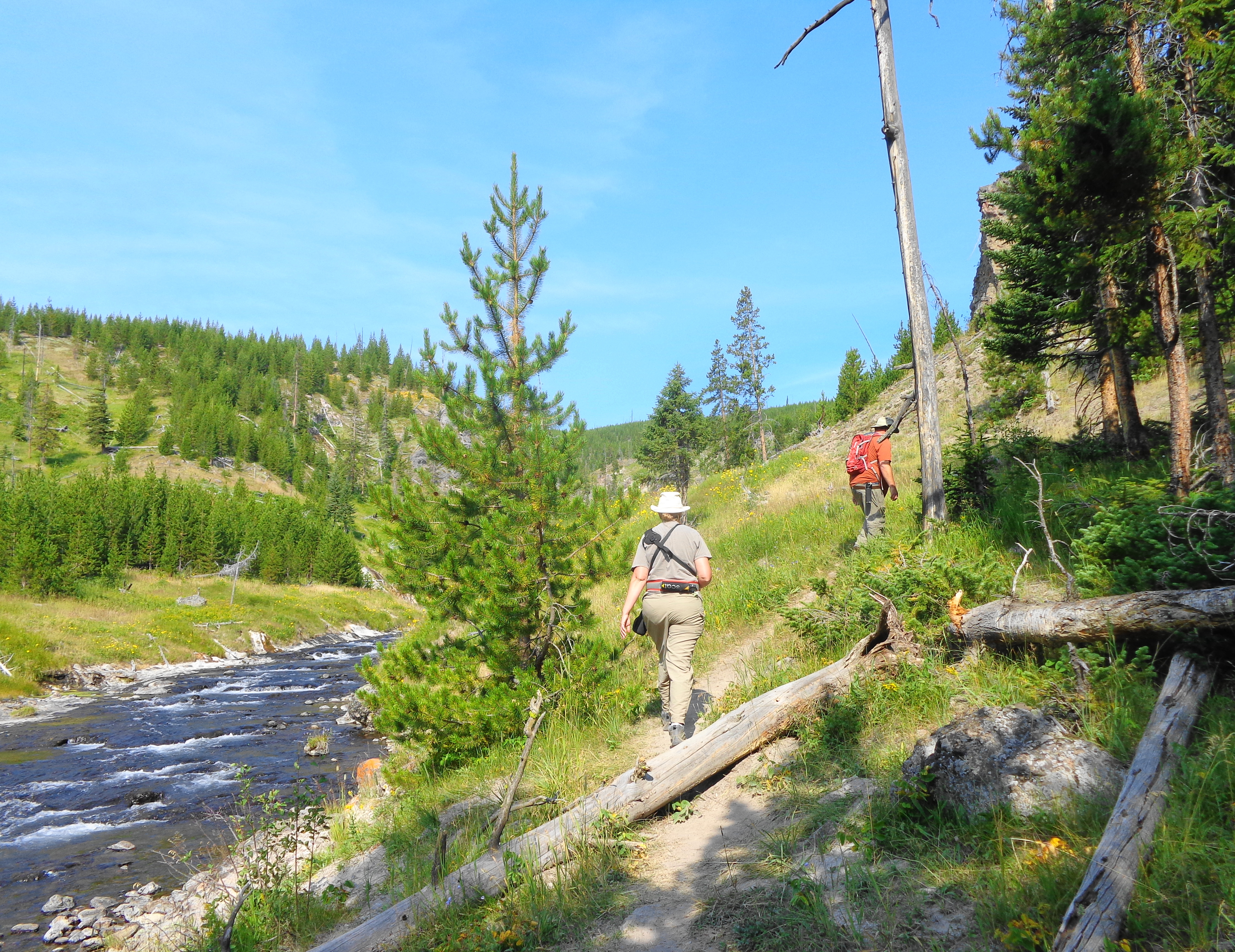
No stop to Yellowstone is complete without a visit to Old Faithful.  It was Roni’s first time seeing the geyser go off.  Despite its name, it did not erupt until 25 minutes after its scheduled time.  The crowd of thousands was growing very restless, and a lot of cheers erupted when it finally went off.  Roni said it was worth the wait!

P1000601 (2)

Although their visit was very short, we had a wonderful time and are thankful Roni and Jodi decided to venture out west to see us!  Our door is always open for our family and friends to visit!

Quote for the day:  “Nobody will understand the craziness of your family better than your cousins.” – unknown


Close Encounters of the Moose Kind!

I have a lot to catch up on with the blogs.  We have been very busy the last few weeks, with visitors, wildlife sightings, packing up the rig, working 8 days in a row, and driving back to Wisconsin.  I will split this up into several posts.  First up:  visitors and wildlife.

September is a beautiful time to visit Grand Teton National Park, as the colors are changing, and the wildlife are very active.  It is the third busiest month in the park, and the weather can be hit or miss.  We had some visitors of our own, Mike and Sue, friends since college, drove out from Wisconsin to visit.  Mike was going elk hunting in Idaho, so he was only able to stay for one night, but Sue was able to spend several days hanging out with us.

We managed to give them a brief tour of GTNP, including a stop at the now peaceful String Lake.  During the summer months, this is a very popular area for swimming, kayaking and stand-up paddle boards.

mah039631

Dan, Jonell, Sue & Mike

We went up by Jackson Lake, and were shocked by how much the lake has dropped since we saw it a month ago.  It should be a good crop of potatoes this year, as Idaho has taken plenty of water from the lake! Idaho has water rights to remove water from the top of Jackson Lake and due to the lack of rain they took a considerable amount this year.

dsc03956-1
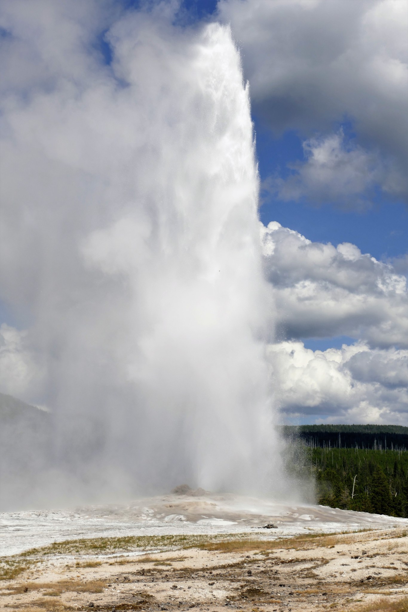
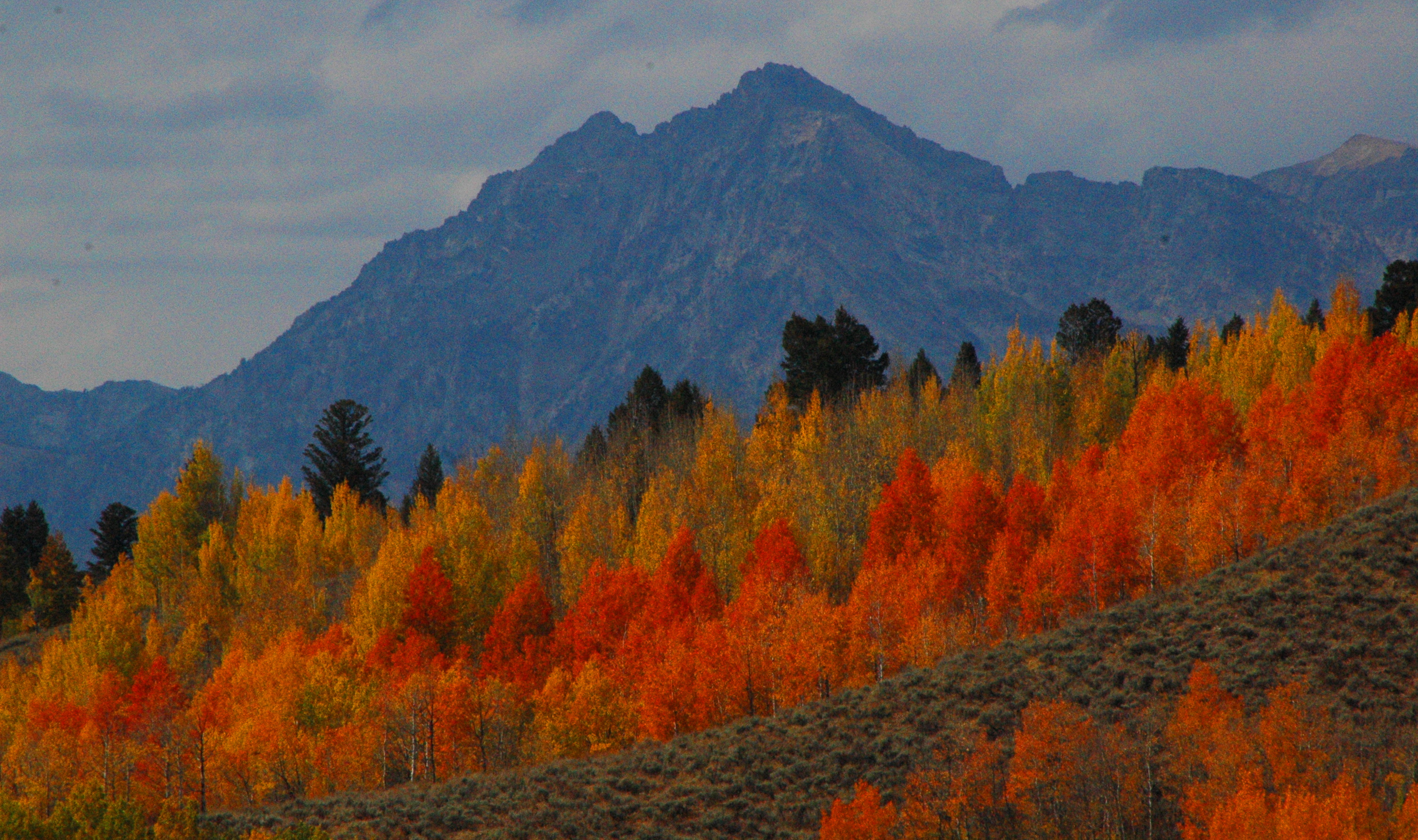
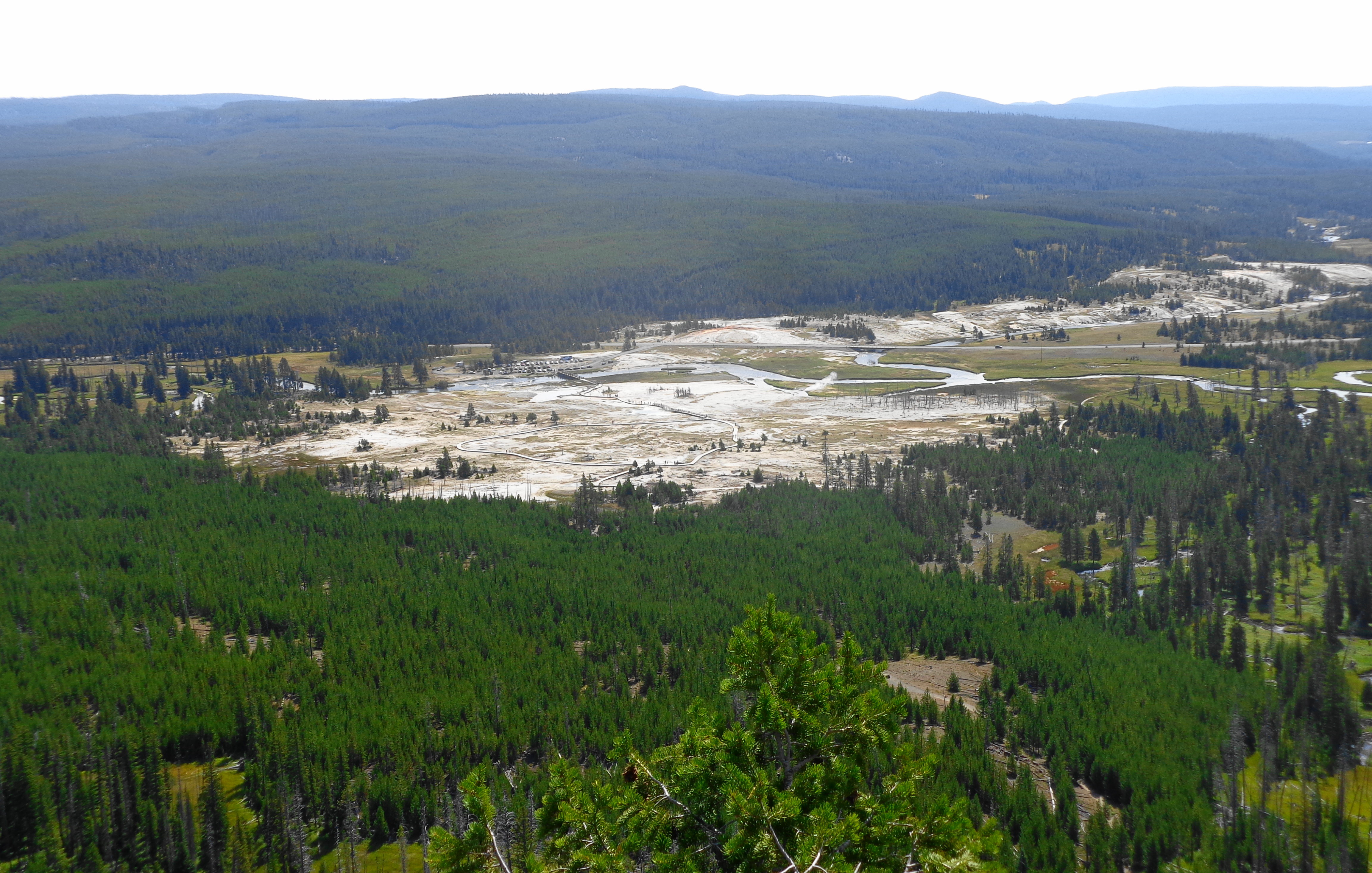
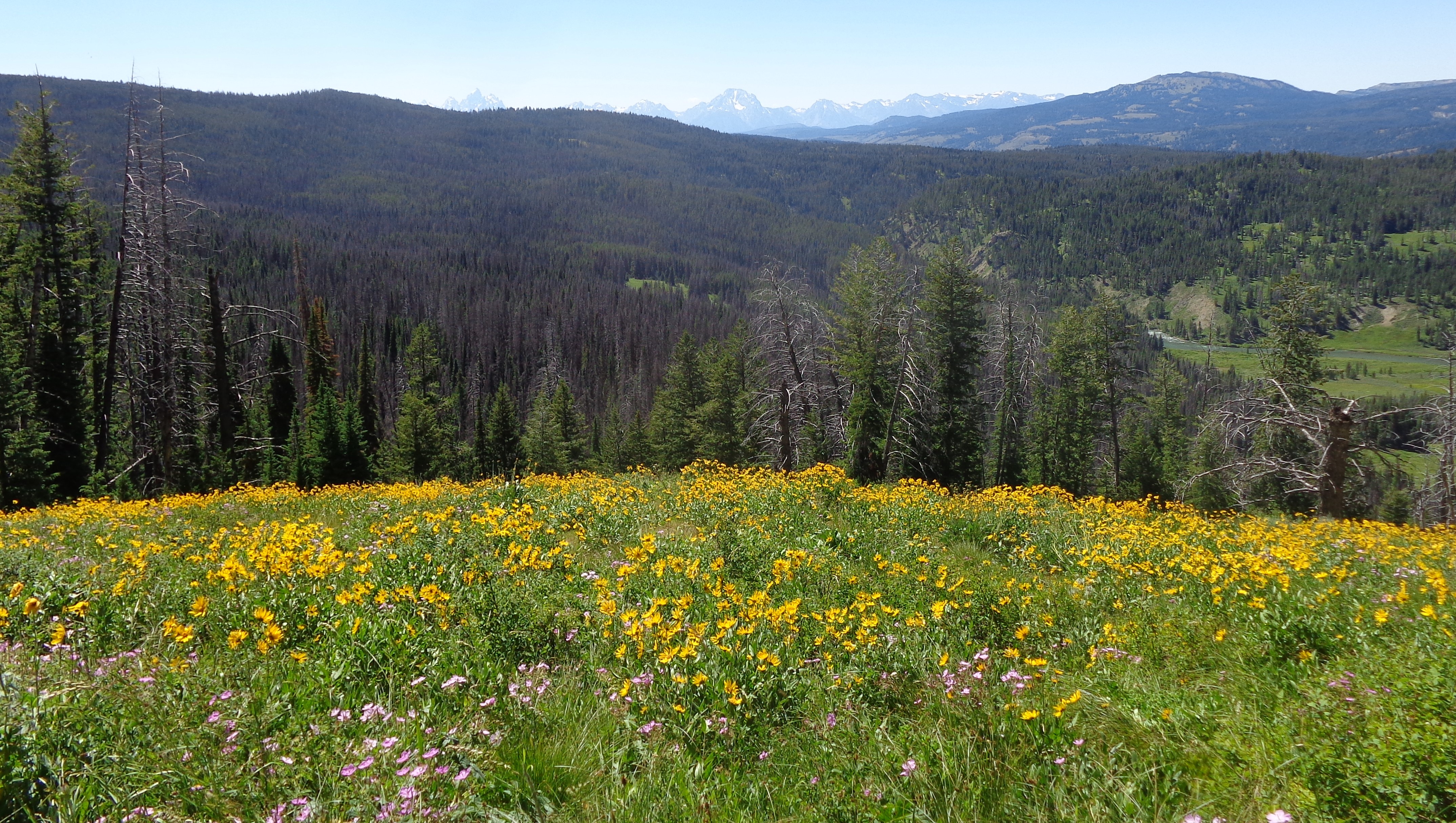
A short drive north of Jackson Lake brought us to the Berry Creek Fire area.  It was sad to see acres of burned forest land, but it will be interesting to watch this area rejuvenate over time.

dsc03959-1During our drive through the park, we spotted a lone female moose.

dsc03972-1
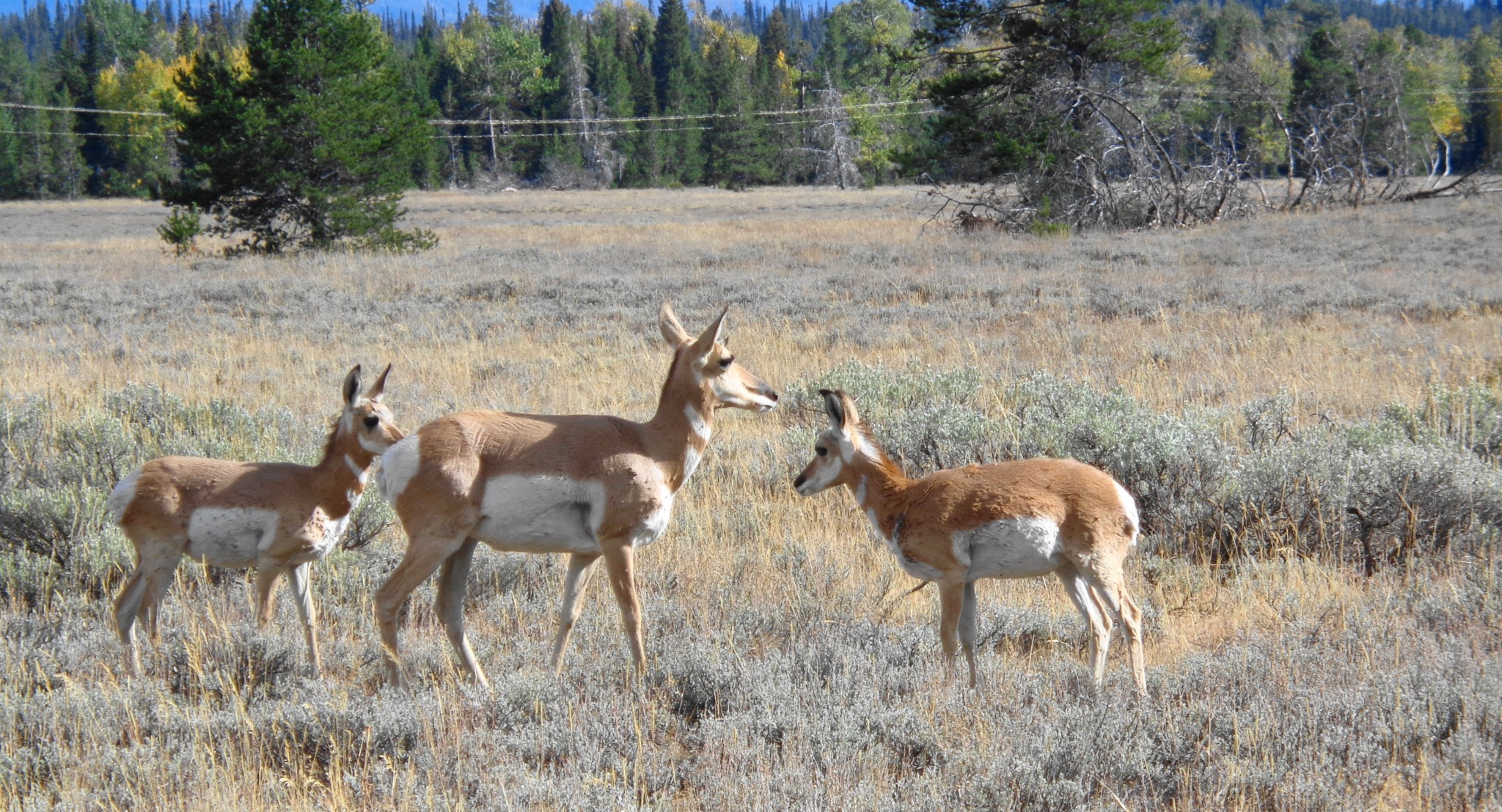
Along with a large heard of pronghorns, including a mama with two hungry babies!

dsc03985-1dsc03980-1dsc03981-1

After Mike left the next morning, the three of us headed out to a short 4 mile hike to Taggert Lake. GTNP has so many excellent hiking trails, and the views never get old.

dsc03990-1
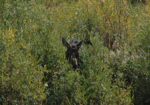
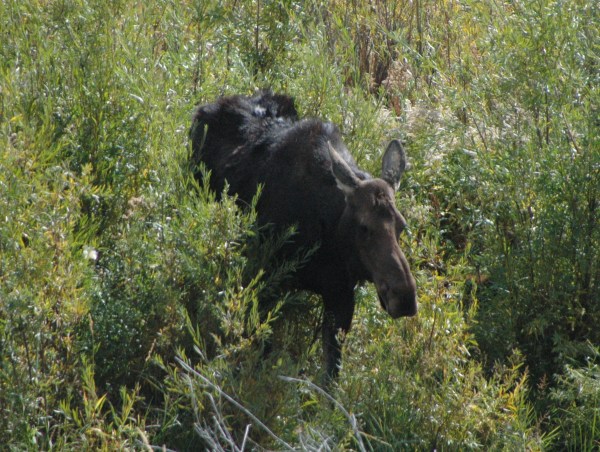
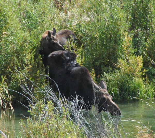
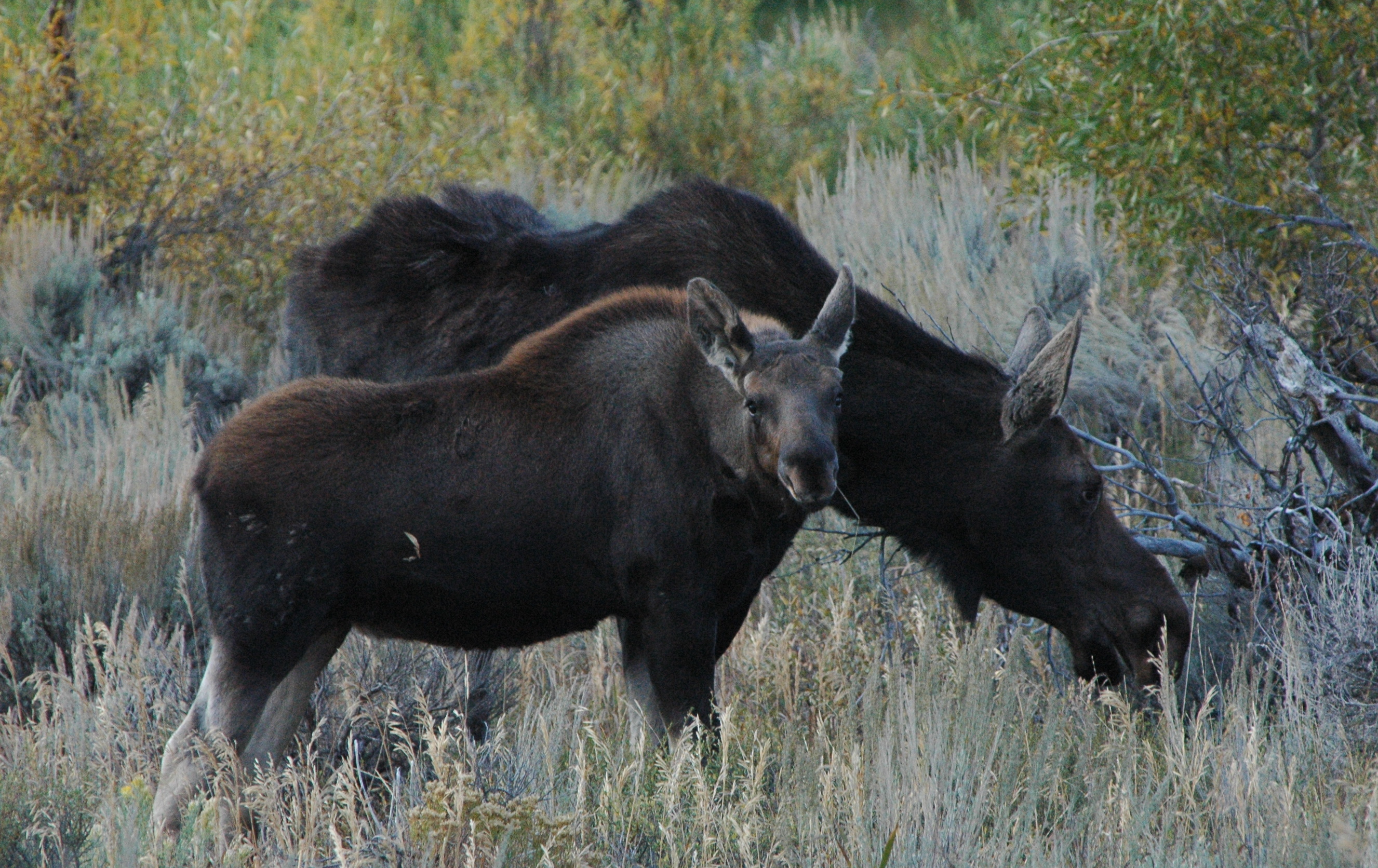
After our hike, we starting driving around and noticed a number of cars pulled off the road, but we could not see what they were looking at, so we pulled over and walked about 100 yards to where the crowd was standing.  And we were glad we did!  At first, we just saw a head of a moose pop out of the willows. But then mama came into full view, followed by a pretty good sized baby.  We watched them for a while until they walked back out of view.

dsc_0443-1dsc_0445-1dsc_0457-1dsc_0464-1

Dan and Sue spotted a bull moose on the way to the airport the next morning, but it was too dark to get a good picture.  So on our next day off from work, we left early in the morning to see if we could spot him again, and we were in luck.  He was still hanging out down by the airport.  The pictures are not the best, as it was early morning, and he was pretty far away.

dsc_0513-1

I did remember to turn around and take one shot of the mountains while we were watching the moose.  You can see the airport on the left.  Jackson Hole Airport is the only airport located within a National Park.

dsc_0527-1

We drove over to the same spot we saw mama and baby moose the prior week, and there was no one around (people that is), so we pulled over and started walking along the river.  Dan was about 30 yards ahead of me, when I saw him jump up and quickly start walking backwards.  Turns out he practically ran right into mama and baby moose, as they were on the opposite side of the river!  Dan was less than 10 yards from the mama moose as she looked right up at him as she was eating some vegetation. Did you know more people are killed by moose than bears?  I managed to take a quick picture of mama moose peering up at me, before we both walked away to a safe viewing distance.  I just love the expression on her face!

dsc_0533-1

We walked away from the moose to a safe viewing distance, and both of them got up and started grazing.  The baby was very curious, and would look over at us.

dsc_0560-1

We capped off our moose-filled day by having lunch with our friends Tom and Ellen.  Ellen’s daughter, son-in-law, and granddaughter were visiting with them up in Yellowstone, and came down hiking for the day in the Tetons.  It was a great way to end a wonderful day!

dsc04004-1

It was a busy, but great week with visitors.  We started packing up the fifth wheel and getting ready for our last stretch of work.  (that will be for the next blog)

Quote for the day: “We do not remember days, we remember moments.” – Cesare Pavese


Fall Colors in Grand Teton National Park

Fall has arrived, and although the weather has been hit or miss lately, the view continues to be spectacular.  Now we know why September is the third busiest month at Grand Teton National Park.  The colors are amazing.  The photos simply do not do justice to the colors.

As I was typing up this blog, I received a notification from Word Press, which is the site that I blog from.  It said today is the third anniversary of this blog!  I was not aware of that.  Amazing how time flies.  And thank you to those who have been following along on our journey.  September 30th will be our last day at Luton’s Teton Cabins.  It has been a great summer, and I will have more next week, wrapping up all of our recent activities and animal sightings.

This will just be a quick, picture filled blog, so enjoy!

dsc_0590-1dsc_0591-2dsc_0594-1dsc_0605-1dsc_0610-1

dsc04003-1

Quote for the day:  “Fall has always been my favorite season.  The time when everything bursts with its last beauty, as if nature had been saving up all year for the grand finale.” – Lauren DeStefano

Yellowstone – summary of recent visits

Today is the 99th Birthday of the National Park Service!

We have taken advantage of having an entire summer to explore at the very first National Park, Yellowstone. We are very grateful that many intelligent folks had the foresight to protect and preserve so many parks, monuments, caves, historical sites, etc., for future generations to enjoy.

Yellowstone is such a wonderful park with so many unique features and areas to explore. Previously I have written about the thermal features in great detail. Instead of doing a lot of separate posts on the different areas, this one will summarize our last several visits.  So this is a bit photo heavy.

ANIMALS

The animals are a big attraction in the park, and sometimes people forget this is not a zoo. The animals are wild, and this is their home. To date, five people have been gored by bison (buffalo). Four of them simply walked up to the bison to take a better picture, and one startled a sleeping bison while hiking. Just remember, bison have no interest in being in your “selfie”! We have seen our fair share of animals, except for a grizzly and Bull Moose in the park. The Lamar Valley area is best known for animal sightings, and we spent a day driving in that area. If you want to see animals, go early (think 6am).

Lamar Valley

Lamar Valley

The park has a lot of Pronghorn’s

pronghorn

pronghorn

As well as bison

where the buffalo roam

where the buffalo roam

And a few bison that seem to hang out right near the road, so you can view them safely from your vehicle

no selfies please!

no selfies please!

But the highlight of our trip this day was seeing a bear foraging for food. We watched him/her(?) about 10 minutes lifting up trees stumps with ease, searching for food. The bear finally stopped and looked back at all the people, and then disappeared into the woods. A park ranger had also stopped, to insure people were not getting any closer to the bear. We stayed in our truck, but many people had exited their vehicles. I think my photo from the safety of the truck turned out just fine. No need to walk closer to the bear.

hmm, tasty people

hmm, tasty people

WATERFALLS

As you are aware from previous posts, Yellowstone has plenty of waterfalls. After viewing the animals, we headed over to Tower Fall, which we had not yet seen. At 132 feet, the falls is a very popular viewing area. It is a very short walk (150 yards) from the general store in the Tower-Roosevelt area of the park.  I am not sure why it is called Tower Fall, instead of Tower Falls.

Tower Fall

Tower Fall

There is a more challenging ¼ mile walk down to the river, but you are rewarded with some nice views in the valley.

Tower Creek

Tower Creek

On our way back up, we encountered a baby pronghorn that was munching away right on the path, oblivious to the warning on the sign!

what sign?

what sign?

MORE GEYSERS

After viewing the falls, we decided to hit the Norris Geyser Basin even though it was over flowing with visitors. They say attendance is way up this year, and we believe that! This geyser basin has a lot a fumaroles (steam vents), which are the hottest of the geothermal features in the park. They have been measured at 280 degrees, and quickly boil away what little water is in the vent.

Norris Geyser Basin

Norris Geyser Basin

steam vent

steam vent

steam vent boiling

steam vent boiling

ARTIST PAINT POTS

On another day we checked out the artist paint pots area, which is a short walk around some mud pots, geysers and hot springs.  The trail climbs to an overlook, which gives a nice overview of the area.

Artist Paint Pots

Artist Paint Pots

mud pot

mud pot

FOUNTAIN PAINT POTS

Another section of the park, on the way to Old Faithful, has more paint pots. Paint pots are a vat of bubbling mud formed by the mixture of heat, gases, volcanic rock, water, minerals, acid and living microorganisms. The pots in the Fountain Paint Pot section are fun to watch.  Photos just do not do justice to these.  You have to watch and listen to them plop and throw mud up and around.

Fountain Paint Pots

Fountain Paint Pots

In this same area, is another fumerole, Red Spouter. This was formed after the earthquake in 1959, which is example of just how unstable the ground is in many parts of Yellowstone. Prior to the quake, it was just a grassy hill.

Red Spouter

Red Spouter

And as luck would have it, we were fortunate to watch two geysers in this area erupt at the same time! Spasm geyser on the left, and fountain geyser on the right.

twin eruptions

twin eruptions

Having our geyser fix, we headed down Firehole Lake Drive to see what was located there. The Great Fountain Geyser, which had erupted the day before, was still very impressive to look at.

Great Fountain Geyser

Great Fountain Geyser

If you notice in the picture above, there is a castle shaped geyser in the background. (you may have to click the picture to enlarge) Shortly after this photo, that geyser started to erupt, so we watched from a distance. Given the relatively few people around that geyser, it was not a planned eruption.

White Dome Geyser erupting

White Dome Geyser erupting

After that one settled down, the Great Fountain Geyser started acting up, spewing a bit of water, before settling back down.

Great Fountain acting up

Great Fountain acting up

We drove over to the White Dome Geyser for a closer look. This geyser continues to get taller every year, as a small amount of silica is deposited on the sides after each eruption.

White Dome Geyser

White Dome Geyser

On our last visit to the park, we explored the West Thumb Geyser Basin and Yellowstone Lake. Due to the wildfires in Montana and Idaho, the air quality has really decreased, and there is a constant haze over the area. We stopped along the road to watch this little geyser erupt, with Yellowstone Lake in the background. You cannot see the mountains on the other side due to the haze.

Yellowstone Lake

Yellowstone Lake

Fishing Bridge used to be a popular area for fishing, but the park service no longer allows fishing in the area, as people were too successful, and the wildlife in the park depends on the fish more than us humans do. I was lucky to snap this photo just as four corvettes were crossing the bridge.

Fishing Bridge

Fishing Bridge

The most famous feature at the West Thumb is this hot springs fishing cone in the lake. Fisherman would boast about how they could catch a trout in the lake, then dunk it in the boiling water in the cone to cook it! This practice was banned in 1911.

Fishing Cone

Fishing Cone

We just never get tired of all the ever-changing features of Yellowstone National Park. It is truly an amazing place. If you have never visited, please put this on your ‘bucket list’. You will not regret a visit to the park, even if you only have a day. Thank you for following along this summer on our trips to Yellowstone. Hopefully you have enjoyed the photos (we have taken hundreds each visit), and learned a few things on geothermal features.

Quote for the day:  “There can be nothing in the world more beautiful than the Yosemite, the groves of the giant sequoias and redwoods, the Canyon of the Colorado, the Canyon of the Yellowstone, the Three Tetons; and our people should see to it that they are preserved for their children and their children’s children forever, with their majestic beauty all unmarred.” – Theodore Roosevelt

Hiking with Friends (x 2)

Wow, it is hard to believe that our time here in West Yellowstone is almost over! We have only 4 weeks left of work, before we start venturing back east for a few weeks to visit with family and friends, as well as dentists and doctors (for Dan….Makena and I are good!). Then we will be heading down to begin our fall jobs at Amazon in Jeffersonville, IN.

The temperatures here still get in the low 40’s at night, with 70’s during the day. It has been a very pleasant summer. We have been venturing into Yellowstone every week, mostly for just a few hours, as it gets extremely crowded. Towards the end of August, it should get better, as the kids start going back to school.

Since we need to start increasing our walking to get ready for Amazon, we met up with friends for two hikes last week.  Originally, I was going to do both hikes in one blog, but decided to split them up, as it was getting a bit lengthy. So the second part will be posted in a few days.

On Sunday, we met up with Karen and Al at Biscuit Basin in Yellowstone for a short 3 mile hike to Mystic Falls. We started out looking at the various geysers in the area, the most famous of which is the Sapphire Pool. It had biscuit shaped formations surrounding it, but they were all blown off in the 1959 earthquake (our previous blog gave more details about this earthquake). The beautiful sapphire color remains, and it is one of the prettiest geyser (as far as color) that we have seen this summer.

Sapphire Pool

Sapphire Pool

The trail starts out relatively easy, and then the trail splits off. We had been advised to “go left” as it was the easier route to the falls. We discovered later that was very good advice, as it is much easier to go down the steeper climb of 700 feet, then up! The trail winds along the Little Firehole River, and is very scenic.

the easy trail

the easy trail

Even though there were “bear aware” signs, we did not see any wildlife at all, except this little guy.

our 'wildlife'

our ‘wildlife’

After less than a mile, we reached the 70 foot high Mystic Falls.

Mystic Falls

Mystic Falls

Karen and Al

Karen and Al

We had 2 options, go back the way we came, or take the more strenuous and less scenic route. We all opted for the latter! The new route back down began with a steep climb, but did offer a nice overlook to the Upper Geyser Basin which is about 3 miles away.

Old Faithful in distance

Old Faithful in distance

We continued climbing, and commenting that we are supposed to be ‘heading down’. Al has a GPS tracker on his iPhone, and it indicated we had climbed over 650 feet in a very short distance. We were happy much of it was in the shade of the trees. We stopped at the ‘scenic overlook’ which looked over the parking lot and the Biscuit Basin where we began our hike. In the upper right corner of the photo is the Upper Geyser Basin where Old Faithful is located.

Biscuit Basin overlook

Biscuit Basin overlook

And then we began a rapid descent, going down switchbacks for most of the way. Al’s GPS indicated we were going down a 12% grade. We met a lot of people huffing and puffing their way up, and were glad we chose the “left” option up, and the “right” option down.  Dan is in the center of the photo below.

heading on down

heading on down

Al is the tiny orange dot in the center of this picture.

Hello Al!

Hello Al!

After we made it back down, we decided to go to the Old Faithful Inn for lunch. After lunch, we discovered a tour of the Inn was in progress, so we tagged along on. The tour lasts about 45 minutes, and is very informative, and includes a view of one of the rooms for rent. This room rents for $109.00 night, and you have your own sink (not original) but do share a bathroom with everyone else on the floor. It was quite the deluxe room back in the early 20th Century!

Old House Room

Old House Room

sink is not original

sink is not original

On the second floor of the Inn, there is an overlook into the dining room where we had lunch.

Dining room

Dining room

The flag inside the Inn contains 45 stars, representing the 45 states at the time the Inn was complete in 1904. By 1912 there were three more stars added to the flag, with Oklahoma, New Mexico and Arizona being added. The remaining two stars were added when Alaska and Hawaii were added to the union in 1959.

45 stars on the flag

45 stars on the flag

We hope to get together with Karen and Al one more time before we leave this area, to do some more hiking.

Quote for the day: “Hiking is just walking where it’s okay to pee.” – Demetri Martin