Bryce Canyon National Park

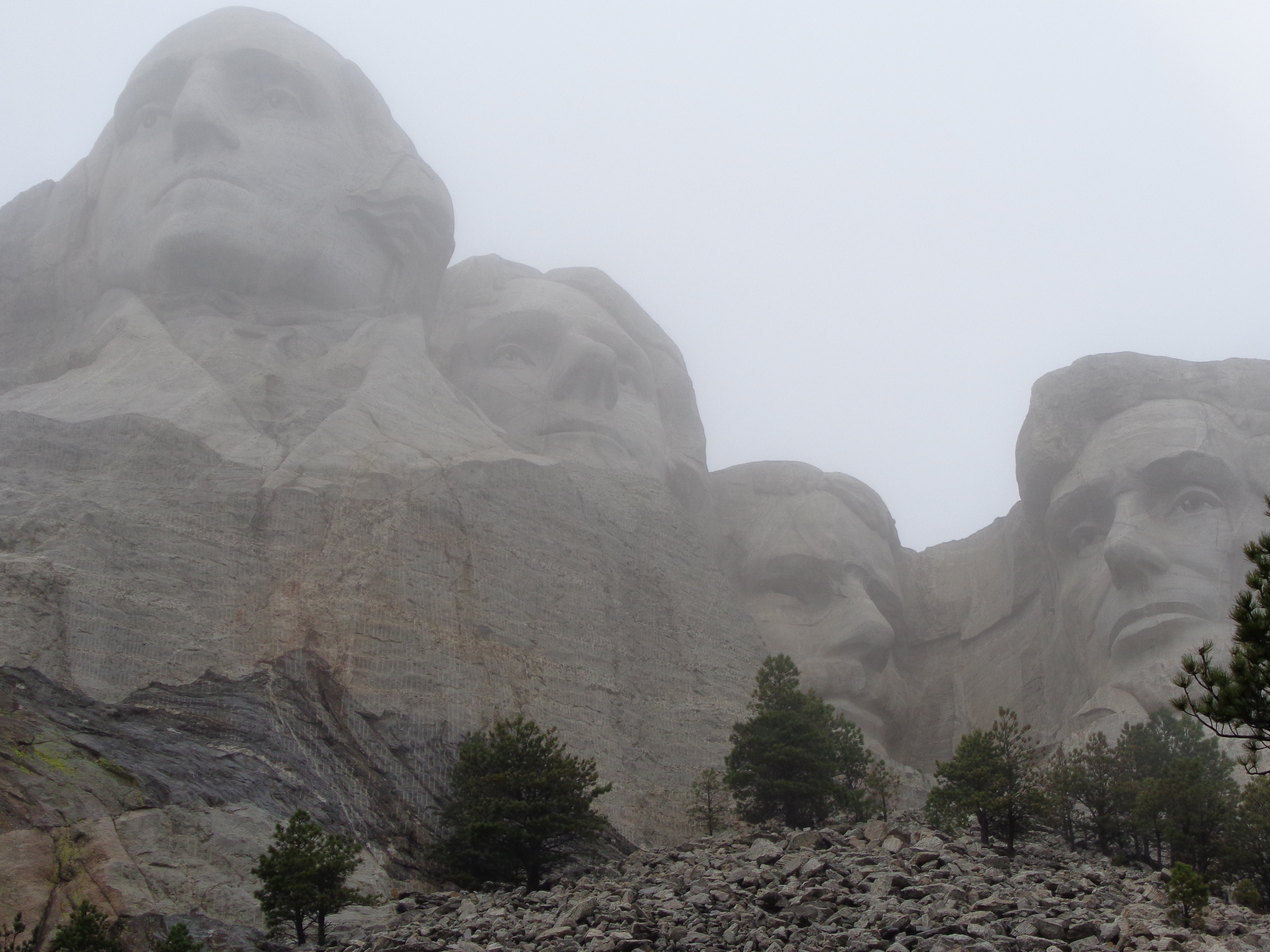
After our short trip to Page with Tom and Ellen, we headed up into Utah, to re-visit one of our favorite National Parks, Bryce Canyon.  The park contains the largest concentration of hoodoos, which are irregular columns of rock.  The hoodoos are formed through erosion of the cliffs from the wind, rain and snow.   As some of the rock formations erode away, new ones are created.  The park is always changing.  As we arrived in the park on May 1, just in time for what seems to be our annual May snowfall!

img_2536

Left Yuma too soon??

Given the snow, and our limited time in the park (2 days), we were not able to do any hiking in the park.  We stayed at Ruby’s Inn campground, in their brand new pull-thru section.  It’s pricey, but very nice.  The family that owns Ruby’s Campground, owns the majority of the businesses in the area.  And they hire a lot of work campers for the season.


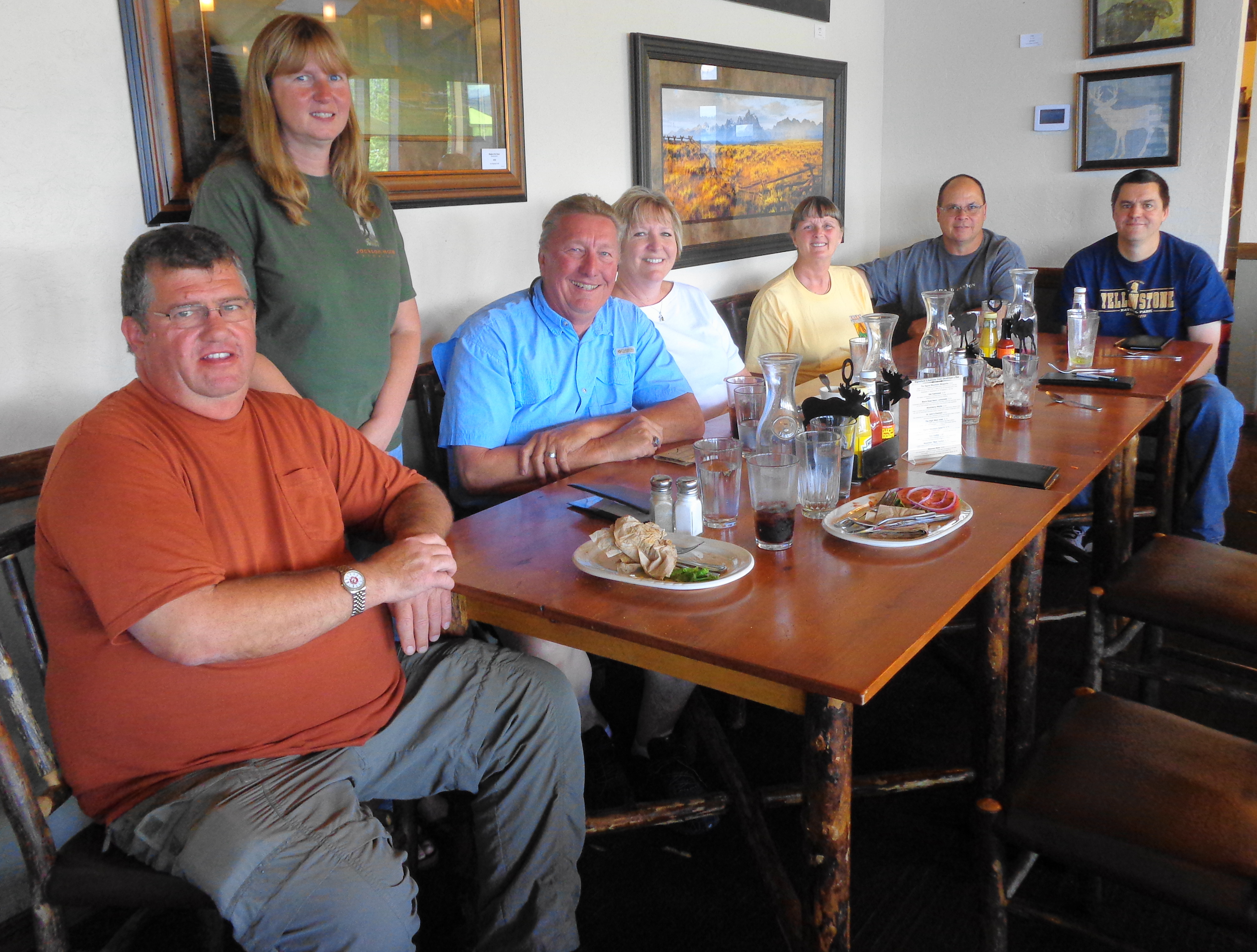
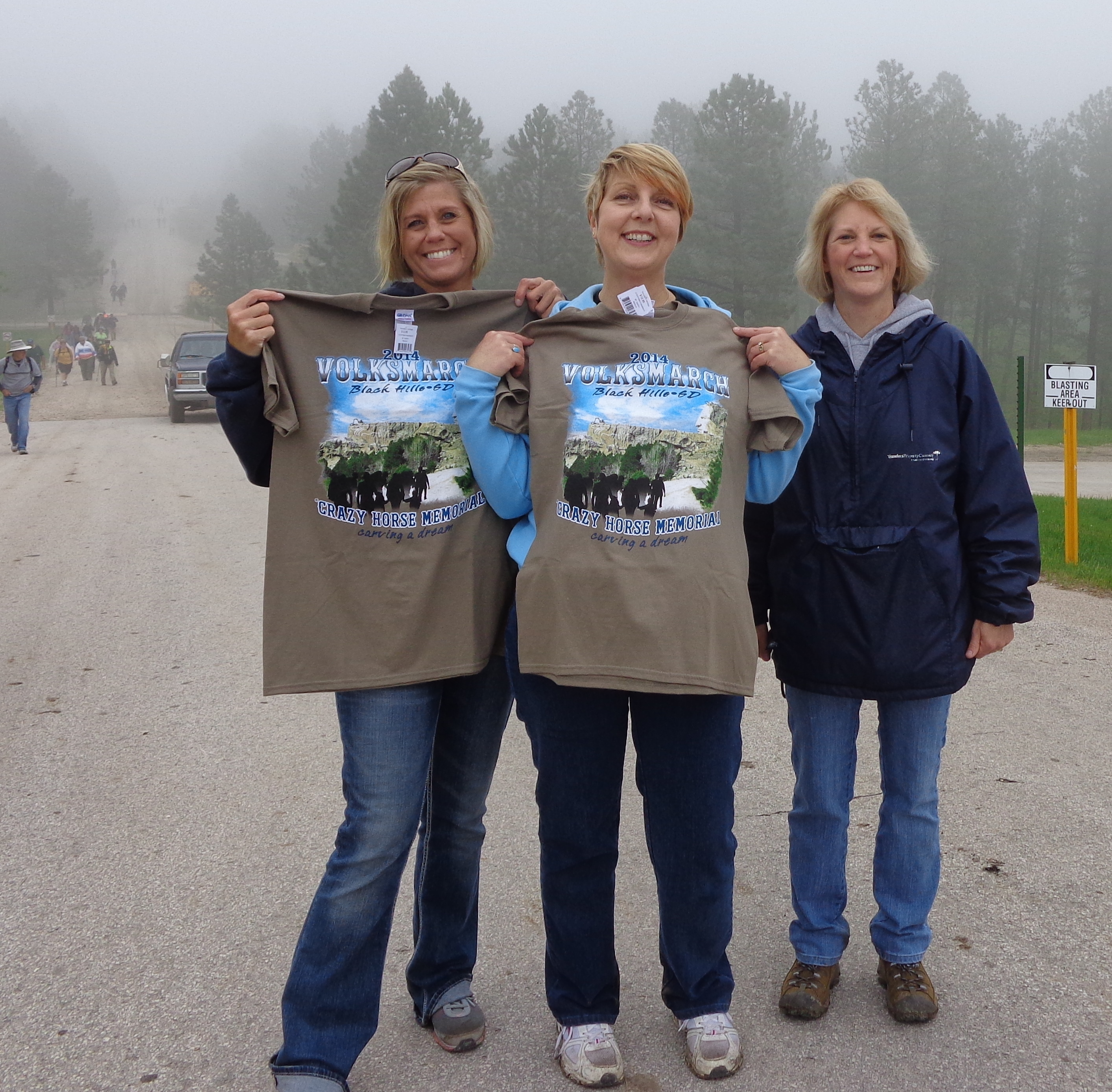
We were able to meet up with our friend Bob, that we worked with at Amazon a few years ago.  Bob decided to get his commercial drivers license, with a passenger endorsement.  This has opened up a lot of high-paying work camping opportunities for him.  In order to ease up on overcrowding, and the pollution that goes along with it, the National Park service is using shuttle buses in many of the parks.  Bryce Canyon has a free shuttle service taking visitors to most of the viewpoints in the park.  Bob was able to get a job as a shuttle bus driver.  For those interested, it pays $24/hour, with a discounted RV site.

img_3045

Bob, Dan, Ellen, Tom and Jonell

When we told Bob that we were coming, he booked us on a free shuttle tour of the park, as he wanted to check out the tour as well.  If you plan on visiting Bryce, I would highly recommend the free tour.  This is separate from the regular shuttle that just takes you to the overlooks. It is called the Rainbow Point tour, and lasts three hours.

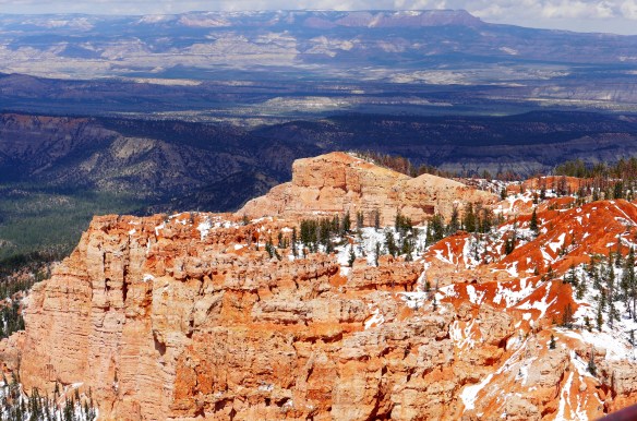
This is the view from Rainbow Point, elevation 9115 feet.  The park borders Dixie National Forest, and off into the distance is Grand Staircase – Escalante National Monument.

P1050023 (2)

This is the view at Agua Canyon, elevation 8800 feet.  Can you see the “face” in the rock formation on the left?

P1050048 (2)

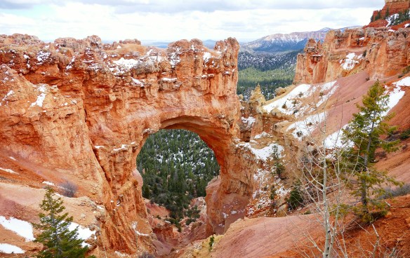
The Natural Bridge is at elevation 8627 feet.

P1050092 (2)

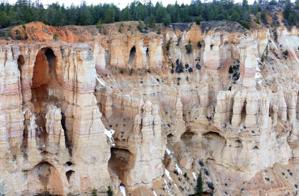
The view at Bryce Point, elevation 8296 feet, is one of the prettiest in the park, containing many hoodoos.  You can hike down into the canyon to get a better view of the rock formations.

P1050201 (2)

More views at Bryce Point…

P1050257 (2)

P1050253 (3)

P1050256 (2)

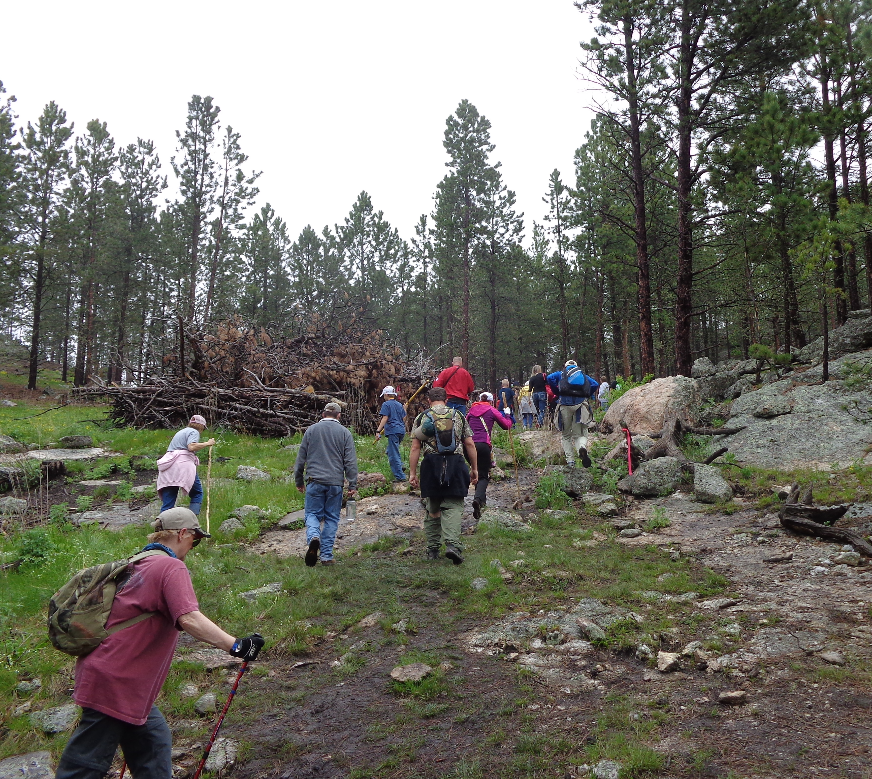
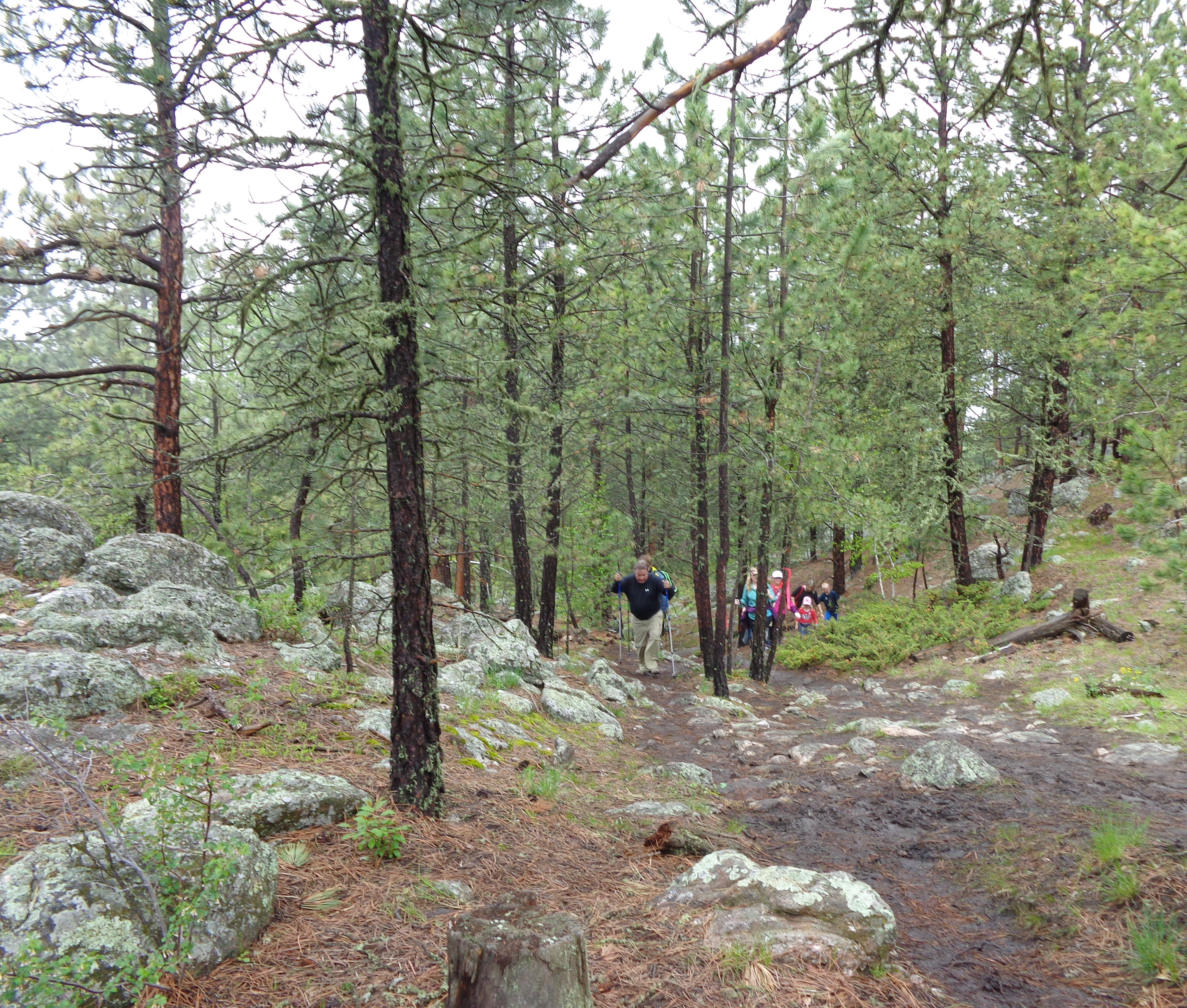
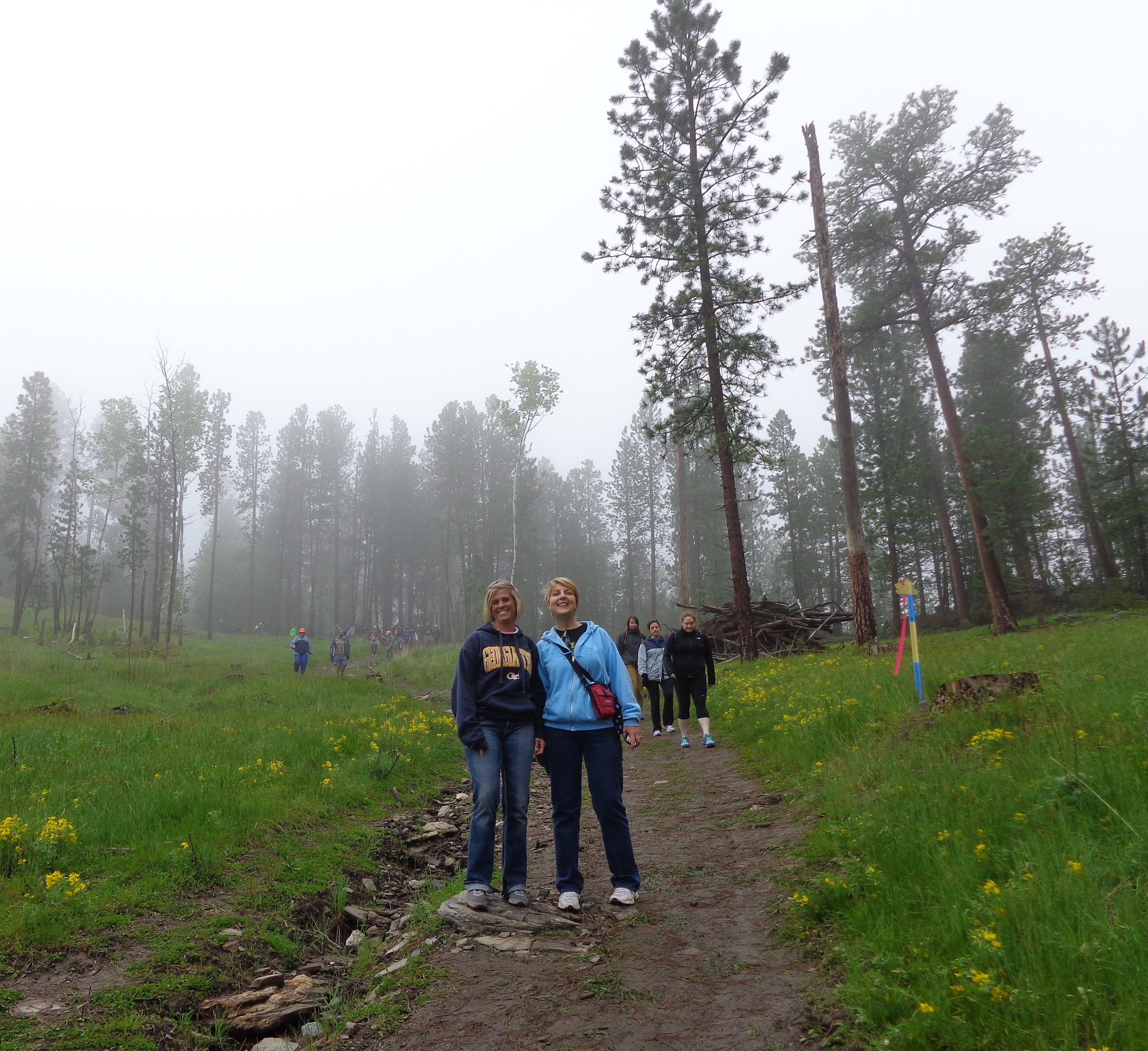
There are over 60 miles of hiking trails in the park, and someday we will return to hike down into the canyon for a closer look at these amazing hoodoo formations.

P1050276 (2)

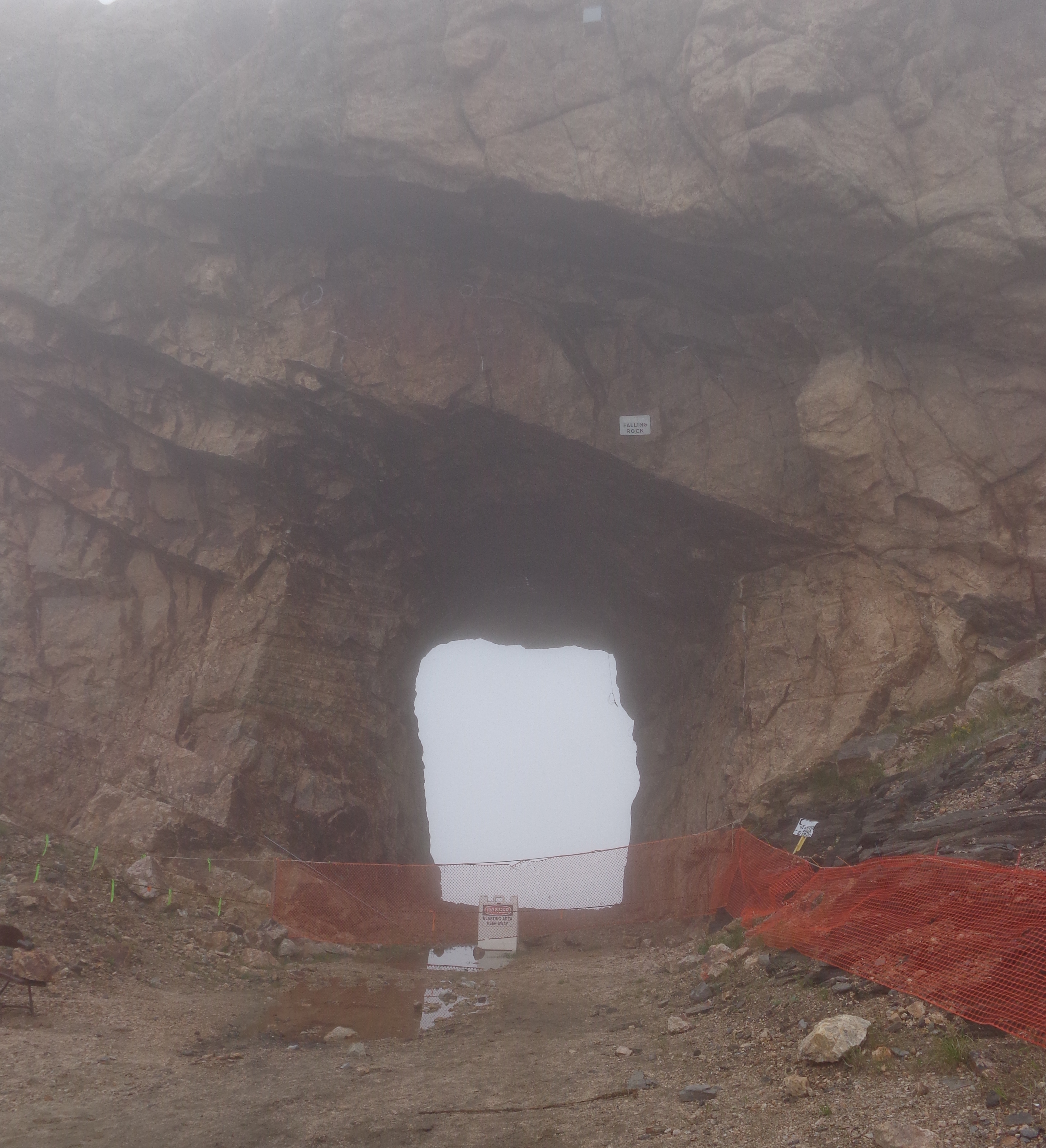
One thing I want to point out for anyone traveling to Bryce Canyon in an RV, they have two arches that you have to drive through to get to the park.  For whatever reason, they have signs stating 13 feet, 6 inches.  This would give pause to anyone driving an RV, particularly a fifth wheel.  The height of our 5th wheel is 13-3.  I’m not sure who did the measuring, but as you can see from Tom and Ellen’s fifth wheel going through the arch, there is plenty of room.

P1050446 (2)

If you are interested in Astronomy, they have special programs at the park in June; and in July, they have programs for those interested in Geology.  We plan on coming back to the park someday to hike down into the canyon.

Quote for the Day:  “Stepping out onto any lookout, you are invited to connect with an amazing example of some of the most unusual terrain on this planet, making you feel as though you are stepping foot on the edge of another world.” – Stefanie Payne


Cousins come a callin’

First off, thank you for all the wonderful comments, e-mails and telephone calls from our last blog post.  It really meant a lot.

Dan’s cousins, Roni and Jodi, made a long road trip from the Twin Cities to come out and visit with us for two days.  We tried to pack as much as we could in the short amount of time they had, and we think we succeeded.  The only thing they were not able to check off their list was seeing a grizzly bear.

We spent the first day on a quick tour of Grand Teton National Park, trying to stop at some of  the highlights: Colter Bay, Jackson Lake Lodge, Signal Mountain, String Lake, Jenny Lake, Lupine Meadows, The Chapel of Transfiguration, Schwabacher Landing, etc…

DSC04471 (2)

Dan, Jodi, Roni

DSC04472

After seeing some of  the highlights, we stopped in Moose for a little pizza at Dornan’s.  While sitting outside we were briefly entertained by a fox walking near the deck.

DSC04474 (2)
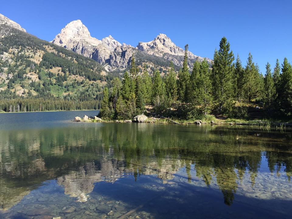
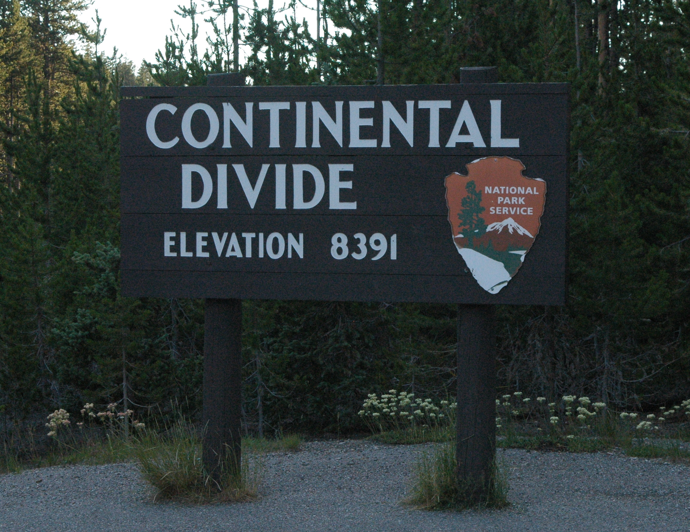
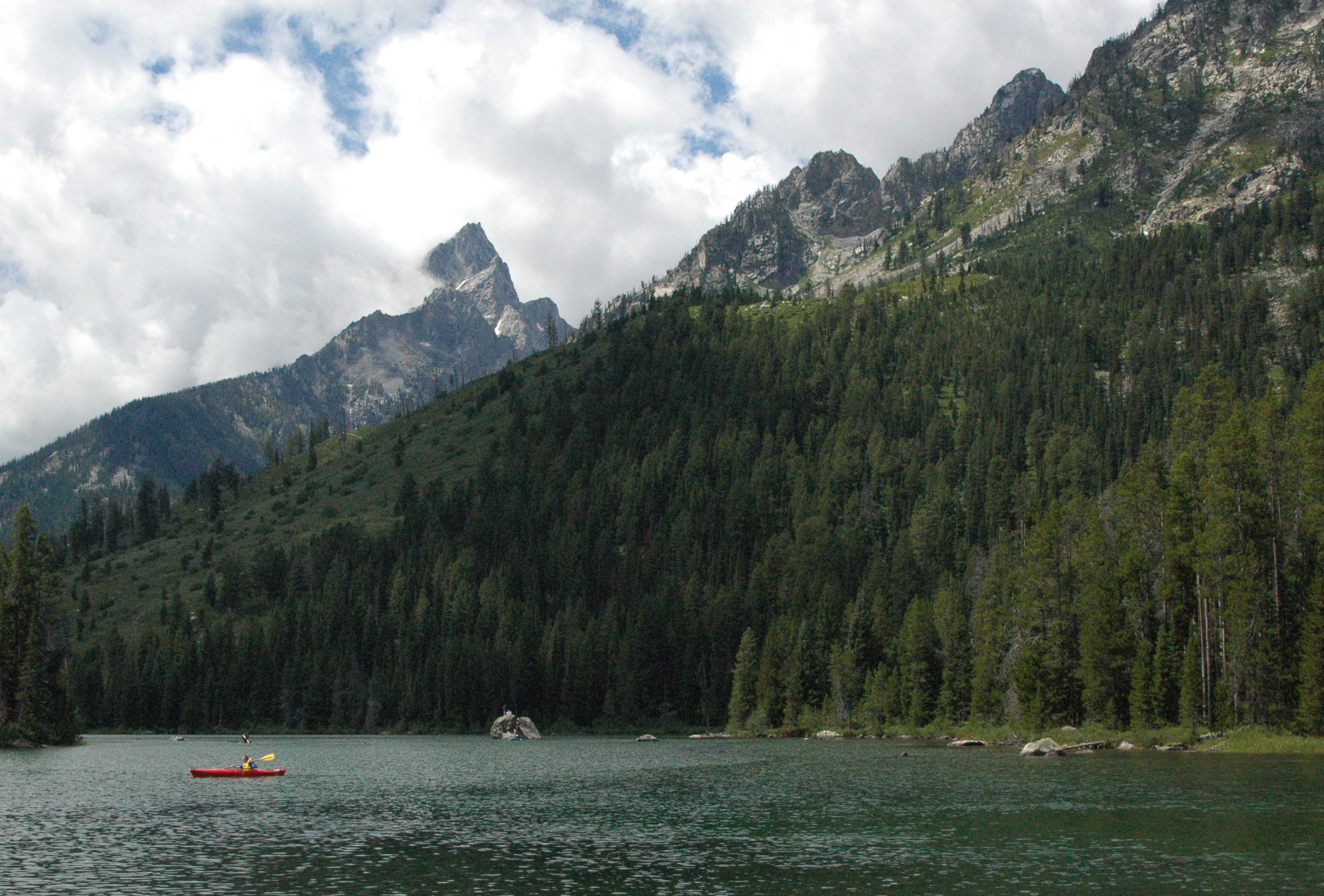
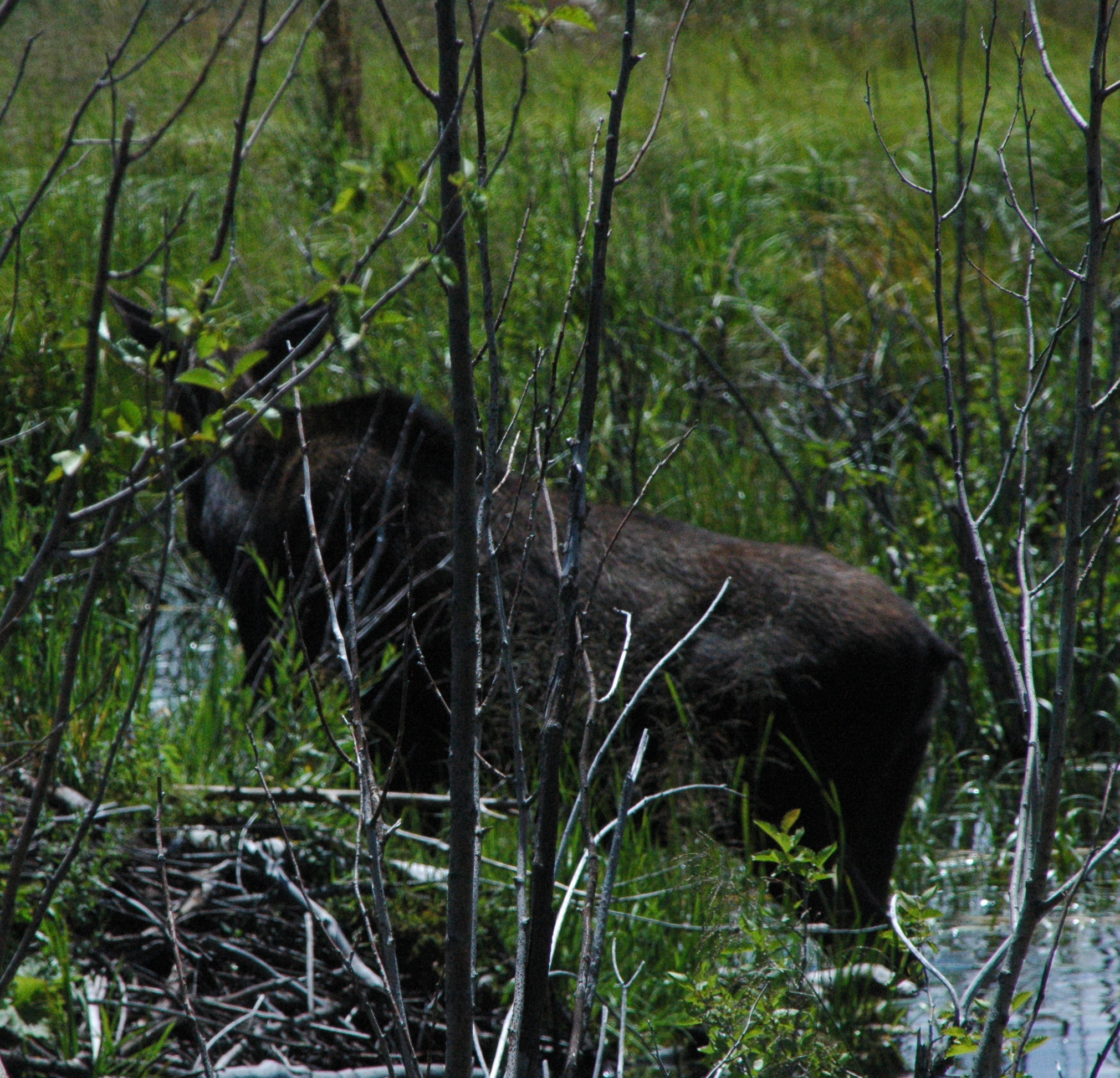
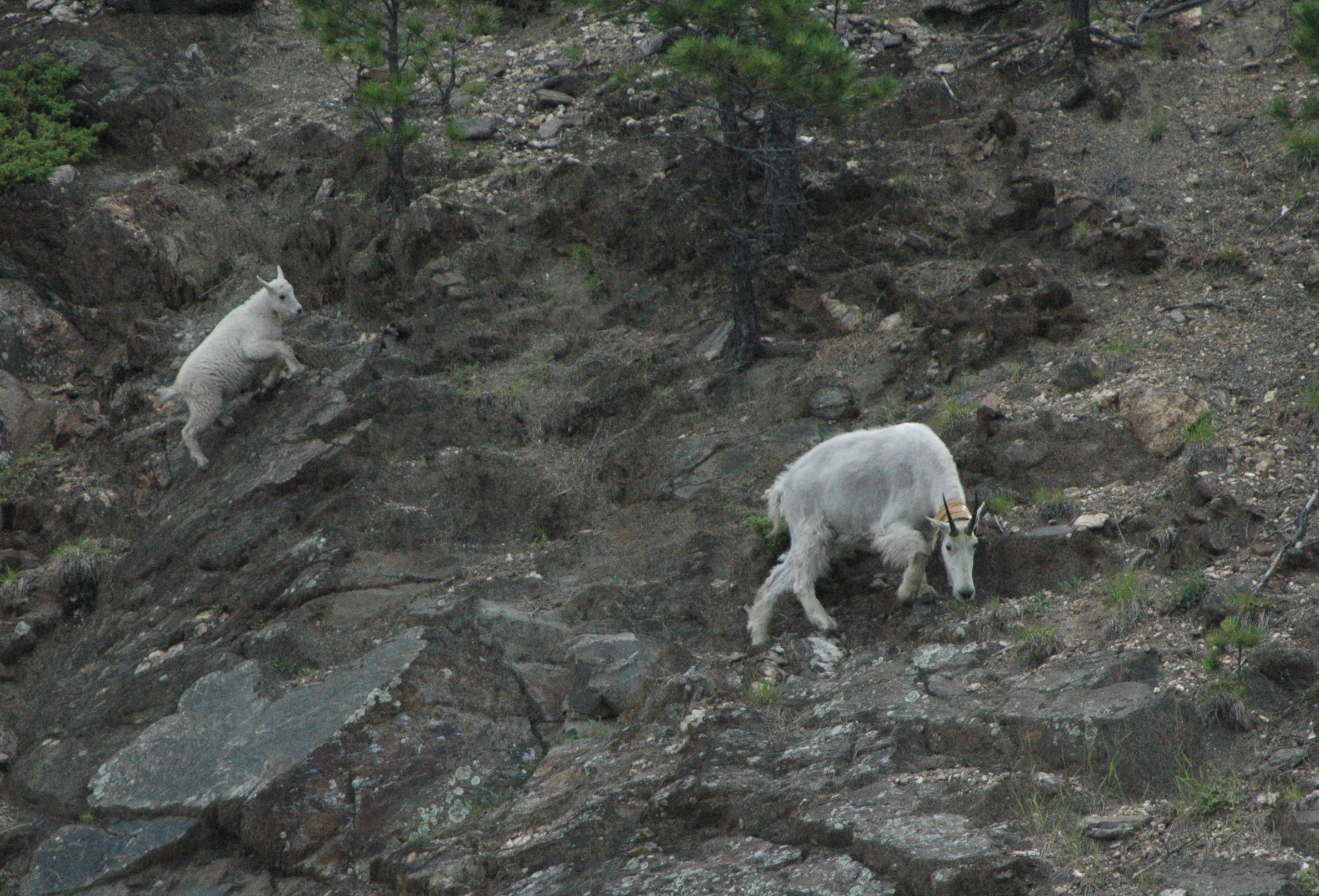
The next morning we headed up to Yellowstone, making a few stops in the Tetons to view a herd of Elk,

P1000307 (2)followed by a mama and baby moose!

P1000363 (2)
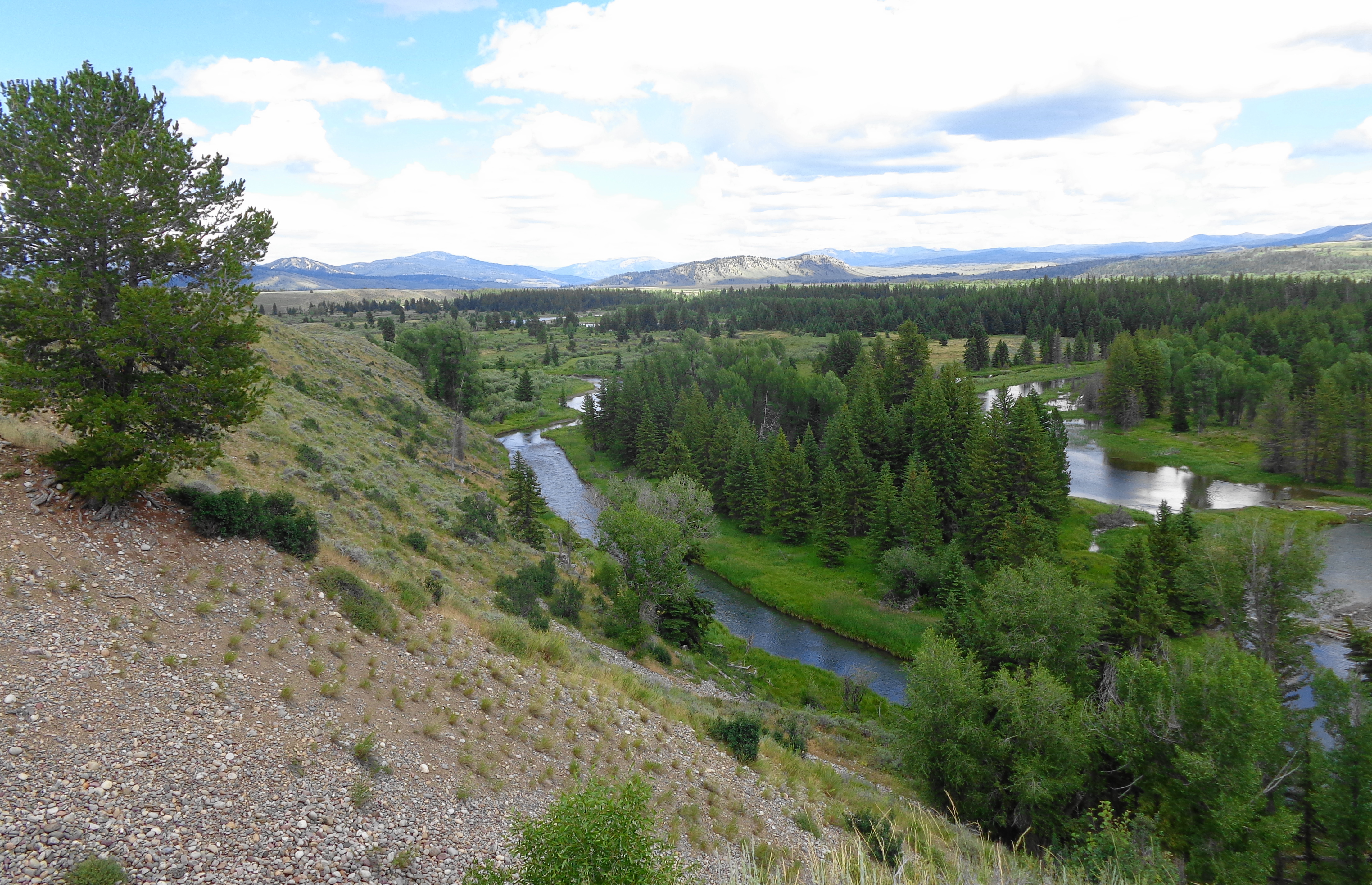
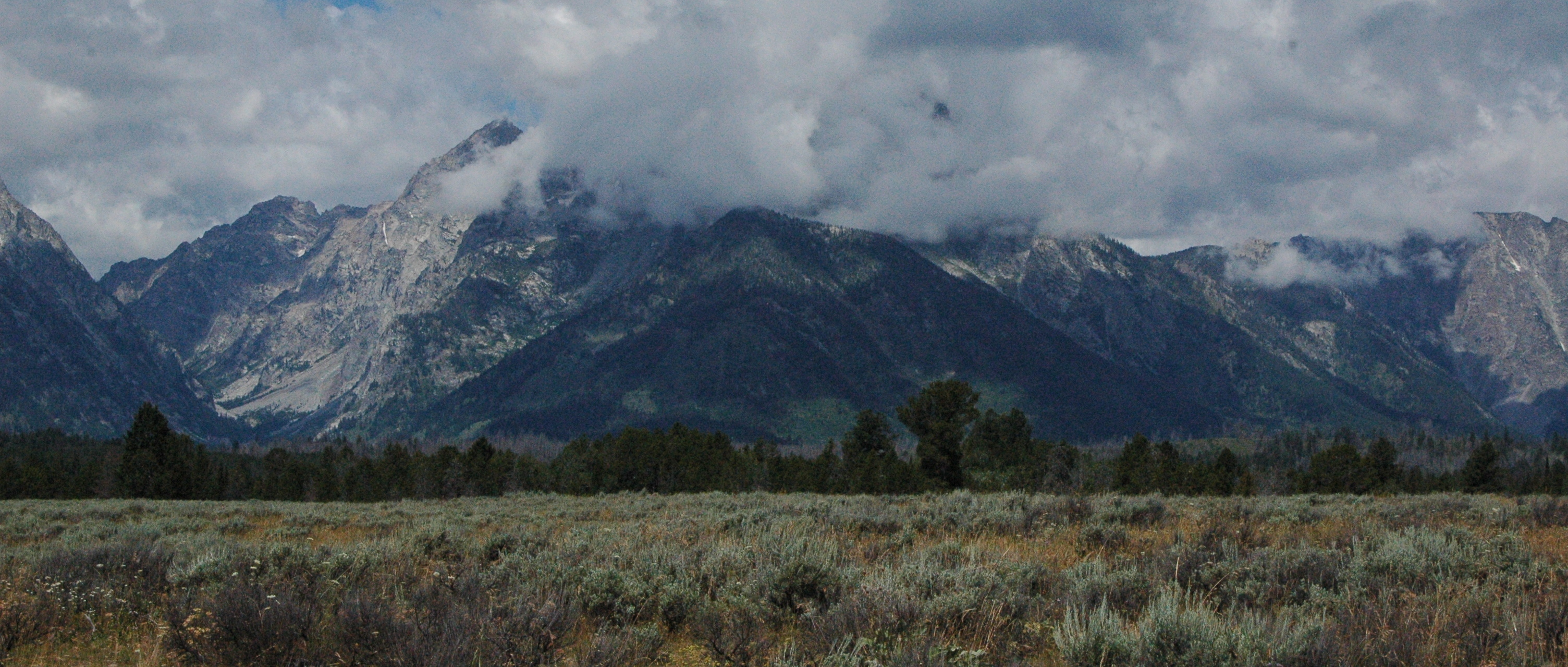
And no morning is complete without a stop at Oxbow Bend, with the low-lying clouds covering parts of Mt Moran.

P1000311 (2)

Yellowstone was pretty busy, but Roni said she had “positive vibes”, especially after our wonderful start to the day.  She was right, and we never had issues finding parking spots!  Our wildlife sightings continued, with an Osprey in a nest,

P1000516 (2)
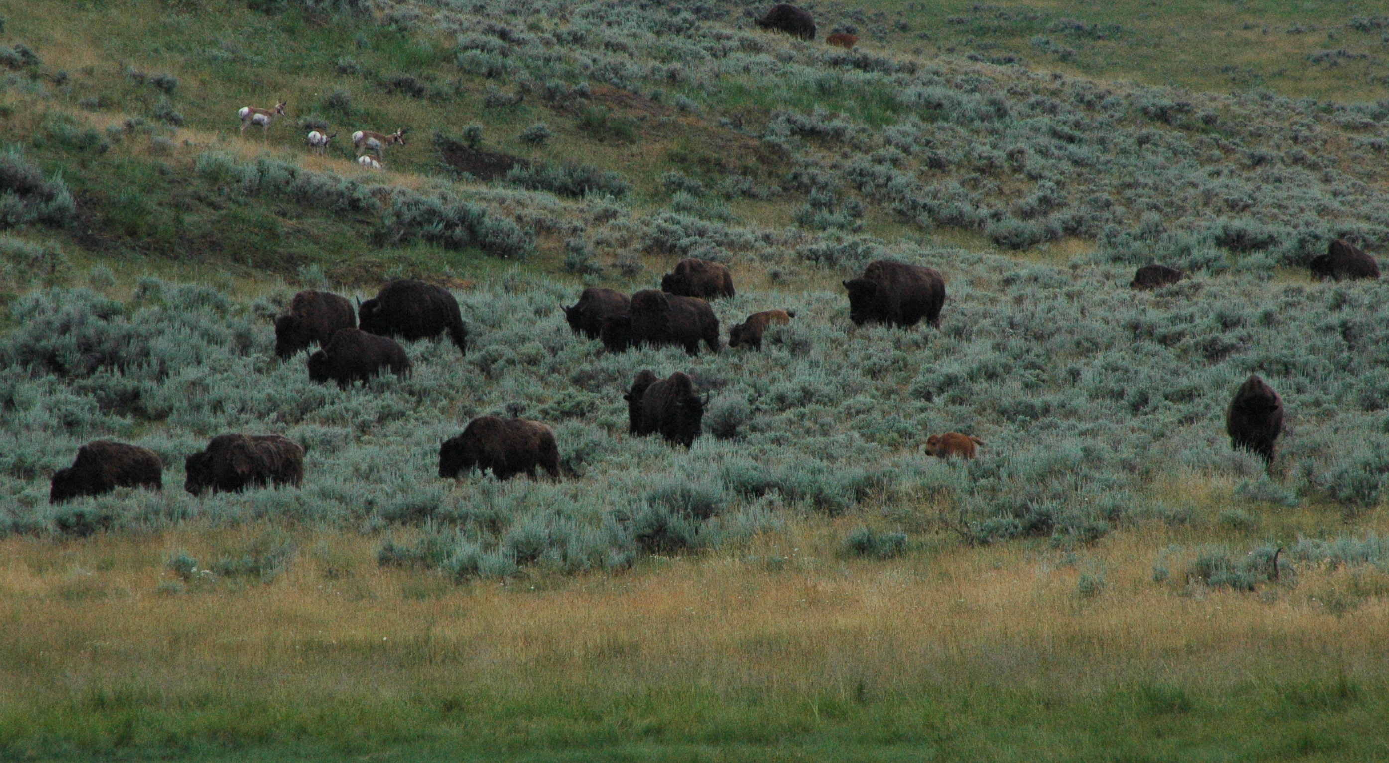
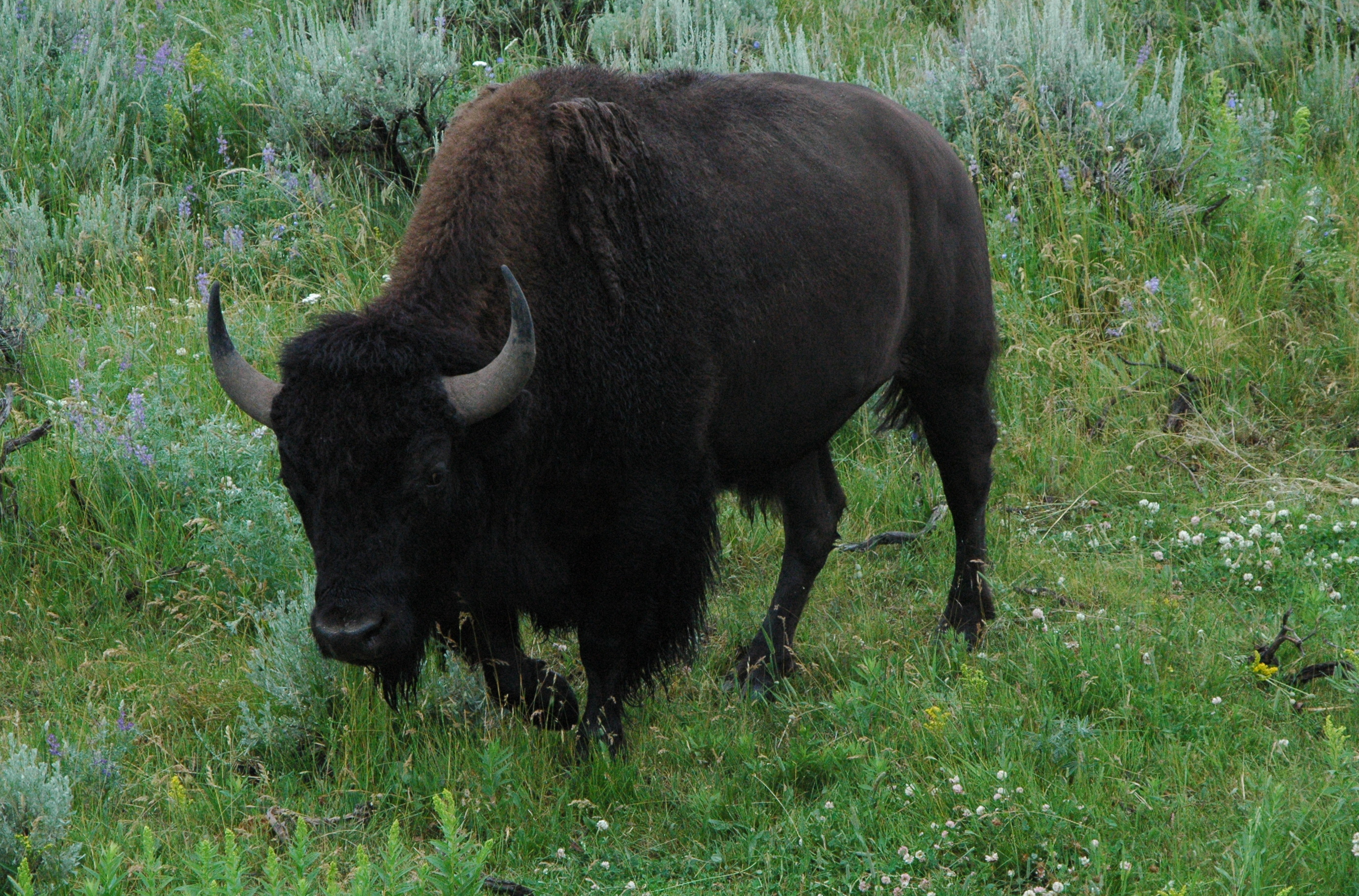
and a lone buffalo taking a nap along the side of the road!

P1000500 (2)The cousins were impressed with the view of the Lower Falls.

P1000429 (2)P1000426 (2)

I think Roni and Jodi may have a new future career in the park service!

P1000472 (2)
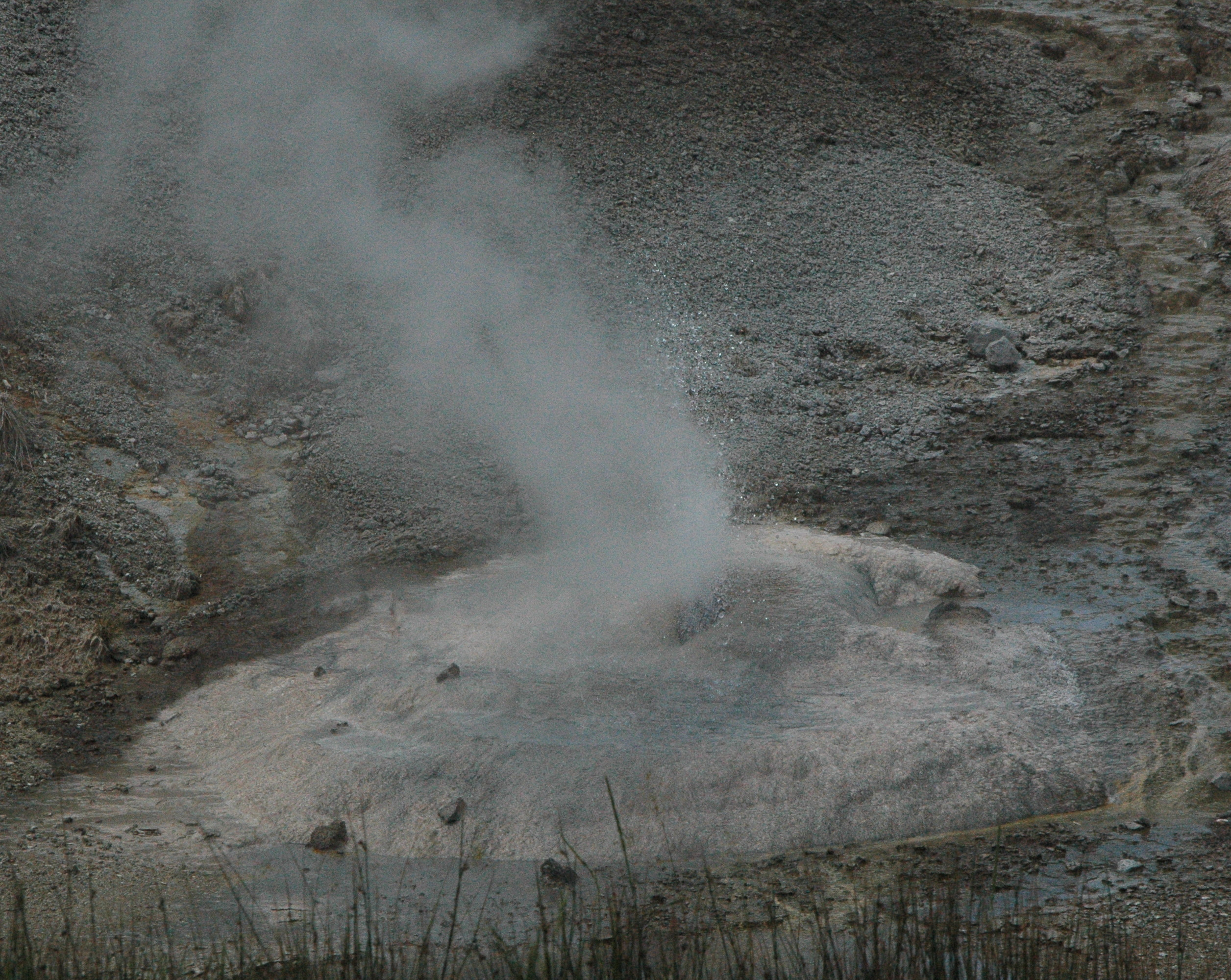
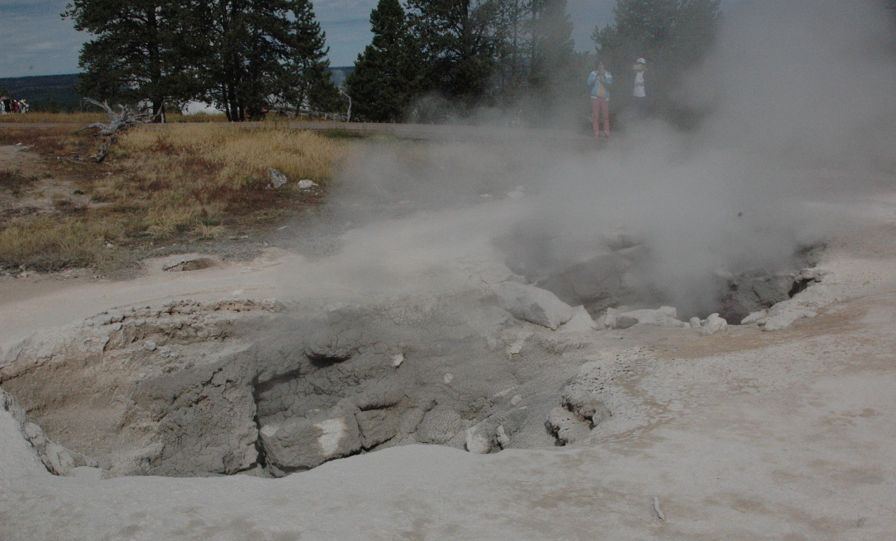
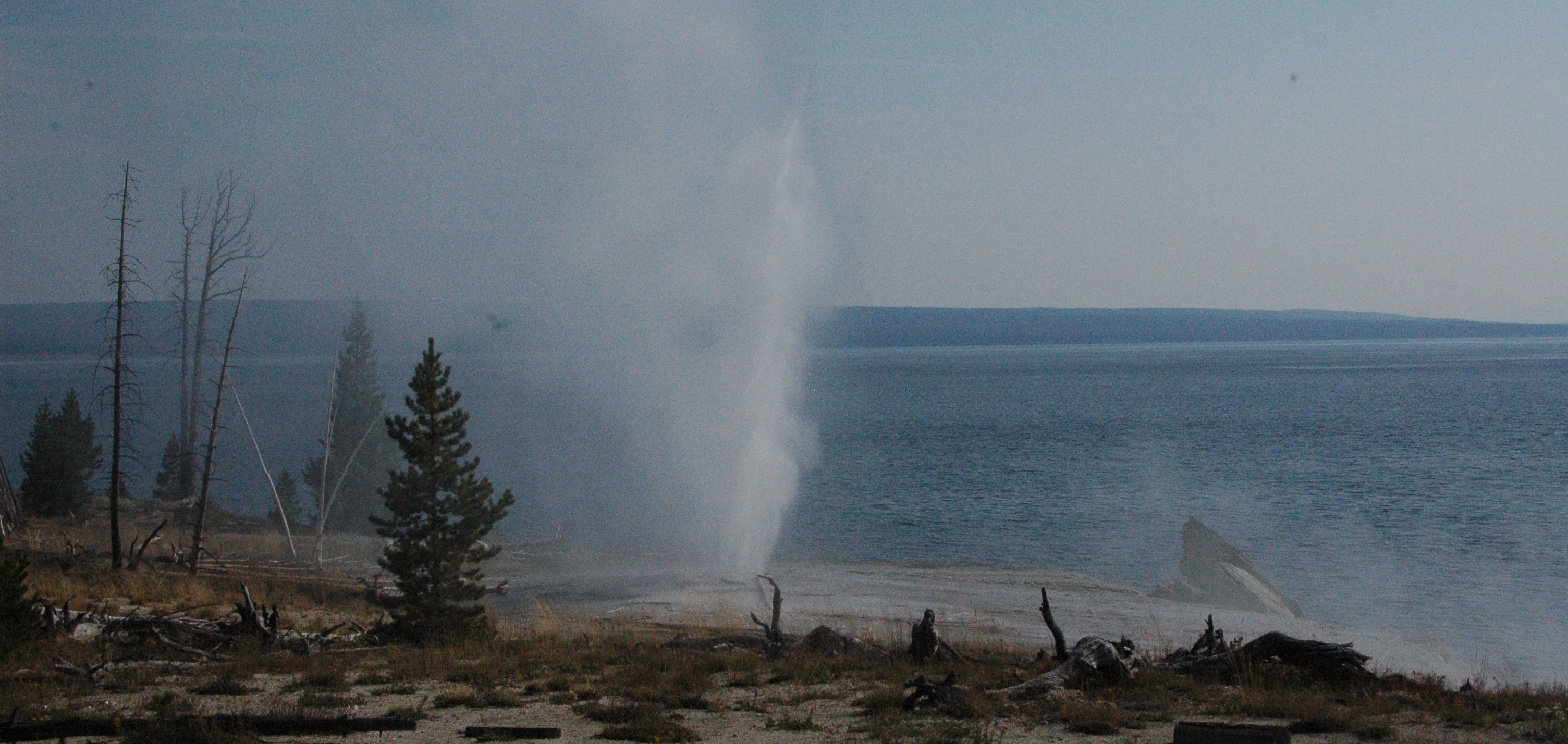
No stop to Yellowstone is complete without a visit to Old Faithful.  It was Roni’s first time seeing the geyser go off.  Despite its name, it did not erupt until 25 minutes after its scheduled time.  The crowd of thousands was growing very restless, and a lot of cheers erupted when it finally went off.  Roni said it was worth the wait!

P1000601 (2)

Although their visit was very short, we had a wonderful time and are thankful Roni and Jodi decided to venture out west to see us!  Our door is always open for our family and friends to visit!

Quote for the day:  “Nobody will understand the craziness of your family better than your cousins.” – unknown


Fire update, tourist time and graduation!

The road to Yellowstone National Park (South Entrance) from Grand Teton National Park has re-opened, thanks to the brave efforts of over two hundred fire fighters.  They spent a week battling the Berry Creek fire that had jumped over Jackson Lake and Highway 191/89.  The fire is still burning, but has been contained enough to keep the highway open.

We had a brief scare last week when a new fire started just 3 miles East of Luton’s Teton Cabins, on US Forest land.  It is believed someone had an illegal campfire which quickly grew out of control.  Because this fire was so close to homes and businesses, they worked to quickly extinguish this fire.  We watched several helicopters dump water on the fire, and they had it out in a few hours.  It made a few of our cabin guests very nervous though!  You can see the smoke and one of the helicopters in the photo below.

image

Just 3 miles away

BOAT/DINNER CRUISE TRIP

Brad and Joanne, the owners of the cabins, surprised all of us with tickets on the Jackson Lake Dinner Cruise.  We only had a week to book the dinner though, as they were shutting down the cruise for the season.  The State of Idaho actually owns the water rights to Jackson Lake.  With it being so dry, the potato farmers have been requesting a lot of water this summer.  Apparently it was the farmers that paid for the dam on the lake many years ago, and in return they received the water rights.  They have been drawing down the lake at a rate of 1 foot every 5 days.  So we booked a Wednesday night cruise with Karen, Al and Jane.  If you look at the far left on the photo below, the water level is normally up to the trees.

DSC03864 (1)

Jackson Lake marina

The boat leaves the marina and docks on an island close to Mount Moran.  The buffet dinner consisted of steak and trout.  The salad bar is served out of the canoe!

DSC03871 (1)

a beautiful setting

We all enjoyed the boat ride over, as well as dinner.  I think Dan was still chewing in this photo!

DSC03872 (1)

Jane, Karen, Al and Dan

After dinner we did a short hike up a steep hill and ha a great view of Mount Moran and the boat ramp on the island below.

DSC03879 (1)

Mount Moran

FLOAT TRIP

A very popular “touristy to-do” in Grand Teton National Park is a float trip down the Snake River.  There are many companies that offer trips.  Barker-Ewing is the company that we recommend to our guests, as they will give them a discounted trip.  To reciprocate, Barker-Ewing gives all of the work campers a free trip.  We finally made time to book an evening float trip, and had a great time.  We would definitely recommend a float trip to anyone coming to the area.  Unlike whitewater rafting, this is more of a “lazy float” down an 8 mile stretch of the river.

DSC_0305 (1)

the boat launched ahead of ours

DSC_0314 (1)

having a good time!

We had good views of the evening sky over the Grand Tetons.

DSC_0336 (1)

Grand Tetons

And beautiful views down the Snake River.

DSC_0331 (1)

Snake River

We were fortunate to see plenty of wildlife along the way as well.

DSC_0400 (1)

a giant beaver home

Along with several beavers in the area.

DSC_0428 (1)

This beaver was busy carrying a tree branch!

DSC_0421 (1)

busy, busy, busy!

We saw quite a few bald eagles, and I was able to get a photo of one of them.

DSC_0376 (1)

a majestic bird

The highlight of our trip was seeing a mama and two baby moose.  Unfortunately, I was only able to capture a photo of one of the babies.  Mama and the other baby were too hidden from my view.

DSC_0390 (1)

Hello!

GRADUATION!

Back in June, when I was still wearing the boot on my foot, we were looking for things to do in the park that did not involve a lot of walking.  Karen suggested a ranger led talk on Menor’s Ferry.  During the talk, Ranger Casey mentioned the Junior Ranger program that they offer in the park (almost all of the national parks have programs).  When the Ranger mentioned the program was not just for young kids, but anyone “young at heart”, well that caught my attention!  One of the requirements of the program is to attend a Ranger led program in the park.  Check!

DSC03763 (1)

Ranger Casey

The booklet that you have to complete has various activities, geared to different age groups.  All Junior Rangers have to complete various activities, from a hike in the park, to viewing some of the historical structures.  For the older kids (and the “young at heart”) there are additional math and science related activities.  (it’s always about math!)

After our ranger led program, I was reading the booklet and commented to Karen, Al and Dan that one of my activities is to pick up litter in the park.  So they all obliged and threw trash down on the ground for me to pick up!  (ummm….thanks?!)  So I studied up on the booklet, and worked on it over the summer.

DSC03773 (1)

Enter a caption

Once I got my boot off and was able to do more in the park, I continued on the program.  Last Wednesday I finally “graduated” and went back to the visitors center for my Junior Ranger oath and badge ceremony!  Al played the ‘pomp and circumstance’ graduation march on his Apple watch!

image

an official Junior Ranger

image

taking the oath

image

my “official” badges

I would highly recommend this program to anyone.  It really forces you to take the time to learn a lot more about the park that you are visiting.


Quote for the day:  “You don’t stop laughing when you grow old, you grow old when you stop laughing.” – George Bernard Shaw

Yellowstone – summary of recent visits

Today is the 99th Birthday of the National Park Service!

We have taken advantage of having an entire summer to explore at the very first National Park, Yellowstone. We are very grateful that many intelligent folks had the foresight to protect and preserve so many parks, monuments, caves, historical sites, etc., for future generations to enjoy.

Yellowstone is such a wonderful park with so many unique features and areas to explore. Previously I have written about the thermal features in great detail. Instead of doing a lot of separate posts on the different areas, this one will summarize our last several visits.  So this is a bit photo heavy.

ANIMALS

The animals are a big attraction in the park, and sometimes people forget this is not a zoo. The animals are wild, and this is their home. To date, five people have been gored by bison (buffalo). Four of them simply walked up to the bison to take a better picture, and one startled a sleeping bison while hiking. Just remember, bison have no interest in being in your “selfie”! We have seen our fair share of animals, except for a grizzly and Bull Moose in the park. The Lamar Valley area is best known for animal sightings, and we spent a day driving in that area. If you want to see animals, go early (think 6am).

Lamar Valley

Lamar Valley

The park has a lot of Pronghorn’s

pronghorn

pronghorn

As well as bison

where the buffalo roam

where the buffalo roam

And a few bison that seem to hang out right near the road, so you can view them safely from your vehicle

no selfies please!

no selfies please!

But the highlight of our trip this day was seeing a bear foraging for food. We watched him/her(?) about 10 minutes lifting up trees stumps with ease, searching for food. The bear finally stopped and looked back at all the people, and then disappeared into the woods. A park ranger had also stopped, to insure people were not getting any closer to the bear. We stayed in our truck, but many people had exited their vehicles. I think my photo from the safety of the truck turned out just fine. No need to walk closer to the bear.

hmm, tasty people

hmm, tasty people

WATERFALLS

As you are aware from previous posts, Yellowstone has plenty of waterfalls. After viewing the animals, we headed over to Tower Fall, which we had not yet seen. At 132 feet, the falls is a very popular viewing area. It is a very short walk (150 yards) from the general store in the Tower-Roosevelt area of the park.  I am not sure why it is called Tower Fall, instead of Tower Falls.

Tower Fall

Tower Fall

There is a more challenging ¼ mile walk down to the river, but you are rewarded with some nice views in the valley.

Tower Creek

Tower Creek

On our way back up, we encountered a baby pronghorn that was munching away right on the path, oblivious to the warning on the sign!

what sign?

what sign?

MORE GEYSERS

After viewing the falls, we decided to hit the Norris Geyser Basin even though it was over flowing with visitors. They say attendance is way up this year, and we believe that! This geyser basin has a lot a fumaroles (steam vents), which are the hottest of the geothermal features in the park. They have been measured at 280 degrees, and quickly boil away what little water is in the vent.

Norris Geyser Basin

Norris Geyser Basin

steam vent

steam vent

steam vent boiling

steam vent boiling

ARTIST PAINT POTS

On another day we checked out the artist paint pots area, which is a short walk around some mud pots, geysers and hot springs.  The trail climbs to an overlook, which gives a nice overview of the area.

Artist Paint Pots

Artist Paint Pots

mud pot

mud pot

FOUNTAIN PAINT POTS

Another section of the park, on the way to Old Faithful, has more paint pots. Paint pots are a vat of bubbling mud formed by the mixture of heat, gases, volcanic rock, water, minerals, acid and living microorganisms. The pots in the Fountain Paint Pot section are fun to watch.  Photos just do not do justice to these.  You have to watch and listen to them plop and throw mud up and around.

Fountain Paint Pots

Fountain Paint Pots

In this same area, is another fumerole, Red Spouter. This was formed after the earthquake in 1959, which is example of just how unstable the ground is in many parts of Yellowstone. Prior to the quake, it was just a grassy hill.

Red Spouter

Red Spouter

And as luck would have it, we were fortunate to watch two geysers in this area erupt at the same time! Spasm geyser on the left, and fountain geyser on the right.

twin eruptions

twin eruptions

Having our geyser fix, we headed down Firehole Lake Drive to see what was located there. The Great Fountain Geyser, which had erupted the day before, was still very impressive to look at.

Great Fountain Geyser

Great Fountain Geyser

If you notice in the picture above, there is a castle shaped geyser in the background. (you may have to click the picture to enlarge) Shortly after this photo, that geyser started to erupt, so we watched from a distance. Given the relatively few people around that geyser, it was not a planned eruption.

White Dome Geyser erupting

White Dome Geyser erupting

After that one settled down, the Great Fountain Geyser started acting up, spewing a bit of water, before settling back down.

Great Fountain acting up

Great Fountain acting up

We drove over to the White Dome Geyser for a closer look. This geyser continues to get taller every year, as a small amount of silica is deposited on the sides after each eruption.

White Dome Geyser

White Dome Geyser

On our last visit to the park, we explored the West Thumb Geyser Basin and Yellowstone Lake. Due to the wildfires in Montana and Idaho, the air quality has really decreased, and there is a constant haze over the area. We stopped along the road to watch this little geyser erupt, with Yellowstone Lake in the background. You cannot see the mountains on the other side due to the haze.

Yellowstone Lake

Yellowstone Lake

Fishing Bridge used to be a popular area for fishing, but the park service no longer allows fishing in the area, as people were too successful, and the wildlife in the park depends on the fish more than us humans do. I was lucky to snap this photo just as four corvettes were crossing the bridge.

Fishing Bridge

Fishing Bridge

The most famous feature at the West Thumb is this hot springs fishing cone in the lake. Fisherman would boast about how they could catch a trout in the lake, then dunk it in the boiling water in the cone to cook it! This practice was banned in 1911.

Fishing Cone

Fishing Cone

We just never get tired of all the ever-changing features of Yellowstone National Park. It is truly an amazing place. If you have never visited, please put this on your ‘bucket list’. You will not regret a visit to the park, even if you only have a day. Thank you for following along this summer on our trips to Yellowstone. Hopefully you have enjoyed the photos (we have taken hundreds each visit), and learned a few things on geothermal features.

Quote for the day:  “There can be nothing in the world more beautiful than the Yosemite, the groves of the giant sequoias and redwoods, the Canyon of the Colorado, the Canyon of the Yellowstone, the Three Tetons; and our people should see to it that they are preserved for their children and their children’s children forever, with their majestic beauty all unmarred.” – Theodore Roosevelt

Two Sundays in the Park

The past two Sundays, we have ventured down to Grand Teton National Park, about 2 hours South of West Yellowstone, MT. The 40 mile long Teton Range was formed over 10 million years ago, during a series of earthquakes along the Teton fault line. The western side of the line rose up, creating the mountain range, and the eastern side sunk down, creating the valley referred to as Jackson Hole. Over two million years ago, glaciers were present, carving out the mountains, and creating Jackson Lake, which is over 400 feet deep. The lake is very popular for boating, canoeing and kayaking.

Jackson Lake

Jackson Lake

Our first visit to the park, was mainly social. We met up with friends, old and new, for lunch at the Signal Mountain Lodge in the park. It was great getting caught up on everyone’s summer jobs, and we have some great opportunities to think about for future work camping positions. Karen and Al are working at Luton’s Teton Cabins. Steve and Joan, along with Maxine and Dave, are working for a company that maps out BLM land.

lunch with friends

lunch with friends

After lunch, instead of driving on the heavily populated main roads, Al led the pack in an off-road adventure on the Snake River. It was a great way to view the park and wildlife, without fighting all the tourists. July is the busiest month for both the Tetons and Yellowstone.

Snake River overlook

Snake River overlook

herd of Pronghorns

herd of Pronghorns

Once we completed our off-road adventure, we headed back to Karen and Al’s fifth wheel, to visit for an hour or so, before saying our goodbyes, as we all had two-hour drives back ‘home’. On our way back, we did stop at the sign in Yellowstone where the Continental Divide passes through the park (I like to take pictures of signs)! The Continental Divide, in case you are wondering, is the line that divides the flow of water between the Pacific Ocean and the Atlantic Ocean. Every continent except Antarctica has their own continental divide.

I stop for signs

I stop for signs

While we were stopped at the pull-out, this gentleman pulled up with a very cool RV set-up. A Ford Falcon (year unknown) towing a T@B trailer.

a cool RV set-up

a cool RV set-up

This past Sunday (July 19), we drove back down to the park to do a little more exploring, and met up again with Karen and Al.   They were running a little behind, so Dan and I stopped in to check out the Jackson Lake Lodge. While we were looking at the scenery out back, a women came up to the man next to me and said ‘did you see the moose’? He shook his head and she said to follow her. I quickly followed her as well! She pointed to an area of tall brush, and we waited and were quickly rewarded with this quick view of a moose!

Moose!!!

Moose!!!

I have never seen a moose before (Dan has while fishing in northern Minnesota with his college roommate Mike) so this was very exciting for me. And then there was more movement in the brush, and we saw a brief glimpse of a baby moose!

Mama and baby

Mama and baby

That just made my day right there! They both went out of sight, and we waited a while, but then continued on to meet up with our friends. We headed up to the top of Signal Mountain, which overlooks the valley.

Signal Mountain View

Signal Mountain View

If you look at the photo above, you will notice a uniquely shaped lake. We discussed various names, and Al came up with “Viagra Lake”. We will leave it up to you to decide what object you think it resembles! We headed back down and continued along the Teton Park Road, stopping at various overlooks. The first one overlooked Mount Moran (elevation 12,605 feet). We had low-lying clouds in the morning.

Mount Moran

Mount Moran

We stopped in at String Lake, which is a very popular swimming and kayaking area. It is also where many of the backcountry hiking trails begin. We saw a number of very tired, but happy guys that were just completing a multi-day hike.

String Lake

String Lake

We continued on down the road, and we were going to stop by Jenny Lake and the Jenny Lake Visitors Center, but they were overflowing with cars and people. We headed down towards Moose Junction to do some hiking in the Rockerfeller Preserve and noticed a lot of cars pulled over with a Park Ranger nearby trying to clear the traffic jam. We were briefly able to see another moose, fairly close to the road! This is when I am glad we have a sunroof in our truck, as I can pop up and take pictures while Dan continues driving.  Now we just need to see a Bull Moose with a big rack.

Another Moose!

Another Moose!

Unfortunately, when we arrived in the parking lot at the Preserve, it was all backed up and the Park Ranger told us there were eight cars ahead of us waiting for a parking spot. We talked it over with Karen and Al, and decided to just head out to lunch. We will plan on a hike later in August, when the park is less crowded. This is certainly a huge advantage to work camping, in that you can pick and choose when to do the things you want. Gone are the days of cramming in everything in one exhausting week of vacation. We see many people at night in the gift store that have “hit the wall” and are just exhausted from battling the crowds all day.

We had a nice late lunch at Dornan’s, which has an upper viewing deck overlooking the Tetons.

our lunch view

our lunch view

After lunch, we headed over to Lower Schwabacher area to view the Grand Tetons, before heading back home. The Grand Teton, at 13,770 feet, is the tallest peak in the range, with the Middle Teton and South Teton beside it. Since the clouds had finally lifted, it was a beautiful view with a nice reflection in the Snake River..

view of Grand Tetons

view of Grand Tetons

Life is Good

Life is Good

We had another great day, with friends, in the park. There are still many more things to do, and we will plan another visit in August. We also plan on spending some time in the city of Jackson, just south of the park. Most people refer to the city as Jackson Hole, but that is the name of the valley region, not the city. And we do plan on coming down through Idaho next time, so we can view the western half of the Teton Range.

Quote for the day: “The mountains are calling and I must go.” – John Muir

A day of Geology and Geography

We are currently in Kentucky, but I will be posting a few more blogs from South Dakota.

With a dog sitter in place for Makena (thanks Dick and Cheryl), we took a day trip over to Devils Tower, Wyoming, about 120 miles from Custer, SD.  In 1906, Devils Tower became the nations first national monument.  It plays a prominent part in the classic “Close Encounters of the Third Kind” movie from 1978.

a view from afar

a view from afar

There are two theories about how the tower formed, one from geologists, and the other from Native Americans.  Geologists agree that the tower is an intrusion, formed by magma, and has been exposed by erosion.  There are multiple theories on how this occurred, but in simple terms, as the rock cooled, it contracted and formed hexagonal columns.  (Todays math lesson: a hexagon has 6 sides)

The Native American legend is several girls were playing and a bear began chasing them.  As they tried to get back to their tribe, they jumped on a rock and began praying to the rock to save them.  The rock, only several feet in height, began rising out of the ground, out of reach of the bear.  The bear attempted to claw its way to the top, forming the “claw” marks on the tower, but was unable to do so.  Devils Tower remains sacred to many tribes today.

getting closer

getting closer


Devils Tower, WY

Devils Tower, WY

There is a relatively easy 1.3 mile walking trail encircling the tower, affording many different views of the columns.  The base of the tower has a large rock pile, from the rock believed to have fallen off after the magna had cooled.  The rocks at the base have been slowly eroding away, further exposing more of the columns of the tower.

Close Encounters

Close Encounters

 Devils Tower, at a height of 867 feet, is a very popular park for rock climbing.  There is a voluntary closure during the month of June, as many Native American Tribes hold ceremonies during this month.  We were able to watch 3 climbers for a while.  If you look closely at the photo below, you can see the three, one at the top center, middle left, and bottom center. (you may need to click on the photo to enlarge it)

3 hikers

3 hikers

In 2008, Japanese sculptor Junkyu Muto installed a sculpture on the property, “Circle of Sacred Smoke”.  The sculpture represents the first puff of smoke from the pipe used by Native Americans during their ceremonies.  The two granite boulders beneath the sculpture are blast fragments from Crazy Horse Memorial.

scultpure

sculpture

view thru sculpture

view thru sculpture

After soaking up all the geology, we heading over to Belle Fourche, SD to finish up with some Geography and History.  Belle Fourche (pronounced Bell Fuush), is the geographic center of the United States of America.

Belle Fourche, SD

Belle Fourche, SD

There is a large monument, with a geographic marker that I am standing on.  Been there, done that!

standing in the middle

standing in the middle

All fifty state flags surround the monument.

the monument

the monument

Also at the monument is the Tri-State Museum (free admission, donations welcome) which has some interesting items on display.  For the ladies that wanted curls, they could go down to the beauty parlor and sit under this machine, that looks like something found in a Frankenstein movie!

high tech perm machine

high-tech perm machine

The museum had a photograph showing a women getting her hair done.  It did not state how long this process took.

getting a perm

getting a perm

Vacuum cleaners have come a long was as well.  This is the Great Northern Vacuum Cleaner, made in Chicago, Illinois.  It is not electric, but a suction plunger model.

vacuum cleaner

vacuum cleaner

This is the Ironrite Mangle, a 1940’s model ironing machine.  You would feed your clothes into the heated roller.

ironing machine

ironing machine

Below is the Hodge Bootery X-Ray Shoe Fitting Machine, which was popular in the late 1940s and early 1950’s.  The shoe salesperson would take an x-ray of your feet to determine your proper shoe size.  In 1950, they realized the hazards from the radiation, and by 1970, 33 states had banned the machines.

shoe x-ray machine

shoe x-ray machine

The museum was also selling a poster of ‘Crazy Horse’, with a disclaimer that it is “believed” to be the only known photograph taken of him, in 1877.  In reality, no known photograph of Crazy Horse exists.

Crazy Horse??

Crazy Horse??

It was an interesting day, and the museum was a nice little find.  We would recommend a trip out to Devils Tower if you are staying in the Black Hills, or as a stopover on the way out West.

Quote for the Day:  “You will enrich your life immeasurably if you approach it with a sense of wonder and discovery, and always challenge yourself to try new things.” – Nate Berkus


Mount Rushmore National Memorial

After our first foggy visit to Mount Rushmore, we returned with our friends Forrest and Mary while they were in town.  As you approach the memorial from Highway 244 out of Hill City, you enter past a turnout that displays a profile of George Washington.  When we pulled in to the turnout, not a single person was looking up at George, and we quickly discovered what all the excitement was about.  There were Rocky Mountain Goats on both sides of the roadway,   We had these two right in the parking lot.

Mom and baby

Mom and baby

And a more adventurous pair across the roadway into the hillside.  These goats were introduced to the Black Hills in the 1920’s, and have adapted quite well to the area.

DSC_0319 (1)When Gutzon Borglum started carving Mount Rushmore, he originally planned to put Thomas Jefferson on the right  side of Washington.  After the workers started blocking out his face, it was discovered there was not enough good quality rock for carving, so they blew up what they hard started.  As a result, it left a good profile of Washington.

profile of Washington

profile of Washington

As you enter the memorial, you go through the Avenue of Flags, which has 56 flags representing all of the states and territories of the US.  It also makes for a popular photo opportunity.

Dan, Forrest & Mary

Dan, Forrest & Mary

The memorial has a Grand View Terrace, for excellent views of Mount Rushmore.  Beneath the terrace if the Lincoln Borglum (named after the sculptors son), which contains a museum, theatre and bookstore.  The museum has a photograph of what Mount Rushmore looked like prior to the construction.

prior to October 1927

prior to October 1927

After Gutzon Borglum died in 1941, his son Lincoln spent seven months working on the monument, but then Congress declared the monument complete on October 31, 1941  This is how the memorial looks today.  The heads are 40 feet tall.  (since we are working at Crazy Horse Memorial, I do have to note that all four heads of Mount Rushmore will fit on the side of Crazy Horse’s head!)

Mount Rushmore 7/2014

Mount Rushmore 7/2014

There is a walking path that takes you a little closer to the memorial, and down to the sculptors studio.  In the studio, there is a 1/12th scale model of what Borglum had planned for Mount Rushmore.  His plans were never completed.  All of the Presidents were to be carved down to the waist.

1/12th scale model

1/12th scale model

The small museum near the visitors center has many photographs and articles that go into great detail on the history of the memorial.  It also talks about the pointer device that was used to project the dimensions from the 1/12th scale model on to the mountain for carving.  This photograph demonstrates an example of the pointer (Math is important!)

pointer device

pointer device

We took the walking path around the memorial, and were able to get a nice photograph of the grand view terrace, and the amphitheater.  They have a nightly lighting ceremony, which we plan on attending one of these nights. (admission to the memorial is free, but there is an $11.00 annual parking pass).

Grand View terrace & ampitheater

Grand View terrace & amphitheater

Mount Rushmore is a “must see” item if you are in the area.

Quote of the day:  “Well, those figures were there for forty million years.  All I had to do was dynamite 400,000 tons of granite to bring them into view.”  – Gutzon Borglum

Jewel Cave National Park

Last week we had a wonderful time visiting with Forrest and Mary, whom we met in Cedar Key, Florida.  They are from Wisconsin, and are slowly making their way out to the Southwest, for the winter.  We all managed to get many things off our ”bucket list” during their visit.  Hopefully I can start getting caught up on my blogs, as I am very behind due to the lack of reliable internet.

Forrest & Mary in Jewel Cave

Forrest & Mary in Jewel Cave

There are many cave tours available in the Black Hills area, and so far the two best ones (in our opinion) are operated by the National Park Service.  We have previously visited Wind Cave National Park, and went with Forrest and Mary to Jewel Cave National Park.

Jewel Cave, Custer, SD

Jewel Cave, Custer, SD

Jewel Cave was discovered around 1900 by two brothers, Frank and Albert Michaud, and their friend Charles Bush, when they heard some wind blowing into a hole in some rocks.  They discovered a cave full of sparkling calcite crystals, and made a claim to this “jewel mine.”  Soon they realized there were no valuable minerals in the cave, and turned it in to a tourist destination instead.  Since “calcite crystal cave” doesn’t sound too exciting, they named the cave Jewel Cave.  The National Park Service took over the cave in 1908 which has protected the cave.

calcite crystals

calcite crystals

In 1959, Herb and Jan Conn were asked to join a cave expedition, and they spent the next 21 years discovering over 65 miles of additional passageways in the cave.  After they retired in 1981, additional explorers have continued discovering and mapping additional passages.   To date, over 170 miles of passageways have been discovered at Jewel Cave.

They offer four different cave tours, and we opted for the Scenic Tour, which is the most popular of the tours (and free with our VIP pass).  At $12.00, it is an excellent value.  The tour covers about 1/2 mile of the cave, in 1 hour and 20 minutes.  You take an elevator down into the cave, and there are about 700 stairs to climb up/down.  Of all the cave tours we have been on so far (still have several others to blog about), this would be the best tour for anyone who is claustrophobic, as this is a very wide open, cavernous cave.

Photography inside a cave is hard to do, because of the lighting, and lack of depth perception in photographs.  To get an idea of the size of this cave, you can see the stairs in the photo below, showing how far down we will be going.

Jewel Cave

Jewel Cave

And then back up again to another area of the cave..

up through a narrow passage

up through a narrow passage

Into a larger room of the cave.

cavernous area

cavernous area

This cave has several interesting formations.  I thought this piece of flowstone looked like a brain.

"cave brain"

“cave brain”

They call this very thin piece a soda straw.

soda straw

soda straw

Curved pieces of calcite on inclined walls and ceilings create these interesting “curtains”.

curtains

curtains

This piece of “bacon” is over 20 feet long.  It is also formed from calcite, but has magnesium in it as well, which provides the coloring.  This was our favorite formation in the cave.  Again, the photograph does not display the enormity and full color of this piece of “bacon”.

mmmm bacon!

mmmm bacon!

Jewel Cave is well worth the visit if you are in the Black Hills.  It is estimated that only 5% of Jewel Cave has been discovered, based on barometric pressure readings of the cave.  Future generations will be able to continue enjoying new discoveries for years to come.  Many visitors inquire about which cave to visit, Jewel Cave, or Wind Cave.  If you have the time, I would recommend both, as they are very different.  If you are short on time, or a bit claustrophobic, then stick with Jewel Cave.  And in our opinion, the National Park Service has done an excellent job in taking care of and preserving both of these caves.

Quote for the day:  “In the United States the best of our national scenery and our most interesting scientific and historic places are retained in public ownership, for the benefit and use of all people.” – Isabelle F. Story

A foggy visit with friends

My friend Angie and her co-worker Brenda took an extended weekend to drive from Wisconsin to the Black Hills to see Mt. Rushmore, and participate in the 10K Crazy Horse Volksmarch. This was a ‘bucket list’ item for Brenda. They arrived on Friday, June 6, about the same time the fog rolled in for the weekend!

We headed off to “see” Mount Rushmore National Park, in Keystone. Admission to the park is free, but there is an $11.00 fee for a parking pass, which is good for the entire year. Dan and I plan on returning to the park, and I will have a more detailed blog on Mount Rushmore at a later date.

When we arrived it was misty and a thick blanket of fog covered up the Black Hills. The entrance to the park takes you through the Avenue of Flags, which has a flag for every state, in alphabetical order. On a clear day, you can see the Presidents in the background.

Avenue of the Flags

Avenue of the Flags


The viewing deck provided this lovely view!


where are they?

where are they?

The fog in the Black Hills comes and goes, so we decided to check out the small museum and watch a short film on the making of Mount Rushmore, while waiting to see if the fog would lighten up.

cell phones off, please

cell phones off, please


And as luck would have it, the fog lifted enough to see George, Tom, Teddie and Abe!


hi guys

hi guys

After that, we went back to Hill City and had a nice dinner at the famous Alpine Inn, which offers two choices for dinner: a 6 ounce bacon wrapped tenderloin or a 9 ounce one.

On Saturday, Brenda, Angie and I met up at Crazy Horse to participate in the annual Volksmarch, which is held annually the first full weekend of June. Crazy Horse also hosts another Volksmarch in late September, during the annual Buffalo round-up at Custer State Park. The Black Hills Volkssport Association organizes the event. The walk is a 10K (6.2 miles) that goes through the woods around Crazy Horse, up to the top of the arm, and then back down with the finish line at the Visitors Center.


let the fun begin

let the fun begin

The terrain in some spots was a bit challenging, but even with the fog, the scenery was nice.


rocky terrain

rocky terrain

many hills to climb

many hills to climb

let's go girls

let’s go girls

The AT&T cellular “tree” was mixed in to the woods. (Now if Verizon would just put a branch on this, we could get service out here!)

AT&T's tree

AT&T’s tree


After an hour of walking, we got our first glimpse of the mountain.


first glimpse

first glimpse

A short while later, we were making it around to the back of the mountain.


around the corner

around the corner

The top is finally near!


almost there

almost there

Congratulations Angie and Brenda!! Another check mark on the bucket list!! And the fog cleared for a few minutes at the top…..


congrats Angie & Brenda

congrats Angie & Brenda


….but soon returned!


the fog is back

the fog is back

We began our descent to the bottom, going past the tunnel under the arm.


tunnel under the arm

tunnel under the arm

And on to the finish line!!


10K complete!!

10K complete!!

If you are interested in seeing more photos of the view from the top of Crazy Horse, please check out our prior blog post from our orientation day when we took a van ride to the top (click here).

After we finished, I headed back to the camper, as Dan and I had to work from 2pm to close, and Angie and Brenda continued exploring the Black Hills. It was a short, but very enjoyable visit with Angie and Brenda. By late Sunday afternoon, the fog finally lifted, but they had already began the drive back to Wisconsin.


Quote for the day: “Life isn’t about waiting for the storm to pass, it’s about learning to dance in the rain.” – Vivian Green

Wind Cave National Park

One of the benefits of working in the tourism area in the Black Hills is the V.I.P. pass that we receive. The pass is for Visitor Industry Partners (VIP) and allows us free or reduced admission for many of the attractions in the area. This way when a visitor asks “what else is there to do”, we can tell them about the other attractions from our own experience. It’s a very smart marketing idea, and we plan on taking full advantage of our pass on our days off.

Our first stop was to Wind Cave National Park. The park offers five different cave tours in the summer. As part of the VIP pass, we received a complimentary Natural Entrance Tour (normally $12.00 per adult), which is the one tour available year round. Admission to the park is free, and they do have a campground.

Wind Cave

Wind Cave


Wind Cave covers over 29,000 acres, with 70 percent natural prairie grassland and 30 percent forest. It is home to many species of animals, including a growing herd of bison. But the main attraction are the cave tours. The cave was first discovered in 1881 by two brothers, Jesse and Tom Bingham, who were out hunting deer. When they heard a loud whistling noise, they followed the sound and discovered a hole in the ground that was blowing air so strong it knocked Jesse’s hat off. The original entrance to the cave is no longer used, as it has a 90 degree turn right when you enter. As such, there is no evidence that bats or animals have entered the cave, because it would be a difficult entry way. At a constant 58 degrees the cave is also too warm for bats to live because they need colder temperatures to hibernate. Dan’s Mom would be happy to know there are no bats in the cave!

This is the original entrance to the cave.

Original entrance

Original entrance


The wind, which gave the cave its name, is created by the difference in barometric  pressures inside and outside the cave. On the day we visited, the wind was blowing in to the cave, as demonstrated by this Park Ranger’s red piece of tape.

winds blowing in

winds blowing in


The Bingham’s told others in town about their discovery, but there is no evidence they explored the cave further. In 1890, 16-year-old Alvin McDonald began exploring the cave, using candles and string (so he could find his way back out). He kept a diary of his daily explorations, which the Park Service has, and uses to document the history of the cave. The McDonald family blasted open passages to the cave and offered tours for a fee, along with selling specimens from the cave. In 1893, Alvin traveled to Chicago to display specimens at the Columbian Exposition, and to market the cave for tourism. Alvin came down with typhoid fever at the Exposition, and passed away in December, at the very young age of 20.

A land dispute erupted between the McDonald family and a mining company (there was no gold found in the cave), and eventually the government stepped in and took control of the cave. In January of 1903, President Theodore Roosevelt established Wind Cave as the seventh National Park (and the first cave), forever protecting the park for future generations.

Studies of the barometric pressure of the cave have estimated that only a small percent of the cave has been discovered. The Park Service is continuing to explore the cave, and it has been “growing” as they continue to find new passages. Right now, there are 141 known miles of the cave, all covering just one square mile of surface area. (ponder that math fact…!)

Wind Cave is famous for formations of Popcorn, Frostwork and Boxwork. Ninety-five percent of all the known Boxwork in caves around the world is found at Wind Cave. On our tour, we saw a lot of Boxwork, and a little Popcorn and Frostwork. The Popcorn and Frostwork is more prevalent in other parts of the cave that can be seen on other tours. Stalagmite and Stalactites are not common in the cave, as it is considered to be a dry cave. The visitor’s center has excellent specimens of the Popcorn and Frostwork, so the following are photographs of the specimens.

Popcorn is formed when small deposits of Calcium Carbonite seep through the limestone.

Popcorn crystals

Popcorn crystals

This is the Popcorn that we saw on part of our Natural Entrance Tour:

Popcorn in the cave

Popcorn in the cave

Water seeps through the porous rock, evaporates, and leaves behind aragonite crystals, called Frostwork.

Frostwork formations

Frostwork formations

We saw one area that had a little frostwork:

frostwork inside the cave

frostwork inside the cave

The Natural Entrance Tour that we took is about 90 minutes in length, and has about 450 stairs to negotiate. It was a rather easy tour to navigate, and we did not feel too enclosed. We would recommend this tour as it was very informative. There was a part in our tour where the Park Ranger turned off all the lights, and lit a candle, so we could see what the early explorers were dealing with. For those so adventurous, they do offer one tour that is strictly by candlelight, so you can experience what touring the cave was like when it was first discovered. They also offer a very strenuous four-hour tour which involves a lot of crawling through narrow passages, so you do need to meet certain “width” restrictions!

The Natural Cave Entrance tour has some narrow passages….

watch your head!

watch your head!

But also some large rooms where everyone can fit, and the rangers will spend several minutes talking about the history of the cave.

wide open rooms

wide open rooms

Boxwork is what this cave is known for, and we saw many examples on the ceiling of the cave.  Boxwork is a honeycomb formation of thin calcite fins that protrude from the walls and ceilings of the cave. The Park Ranger explained that when they were first exploring the cave, using candles, the Boxwork initially looked like giant spider webs.  That is what is documented in the diaries they have of the early cave explorers.

Boxwork formations

Boxwork formations

Photographs of caves are not the best way to see a cave.  We definitely would recommend a visit to Wind Cave (remember…no bats!)

inside wind cave

inside wind cave


Quote of the Day:  “The cave you fear to enter holds the treasure you seek.  Fear of the unknown is our greatest fear.  Many of us would enter a tiger’s lair before we would enter a dark cave.  While caution is a useful instinct, we lose many opportunities and much of the adventure of life if we fail to support the curious explorer within us.” – Joseph Campbell